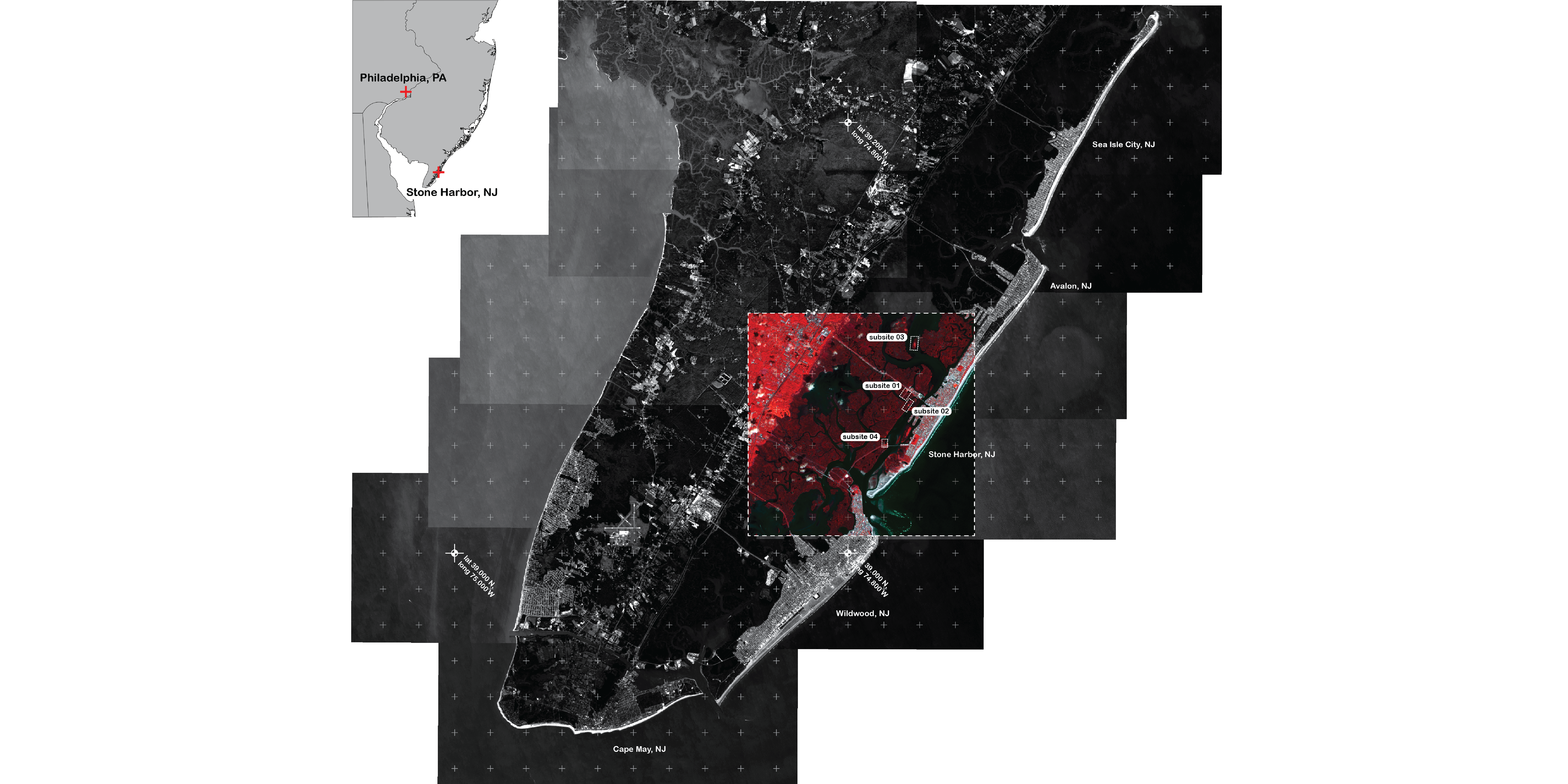
A color infrared satellite composite image of the Jenkins Sound study area in Stone Harbor, NJ, showing the location of the four sites surveyed to locate high marsh grasses.
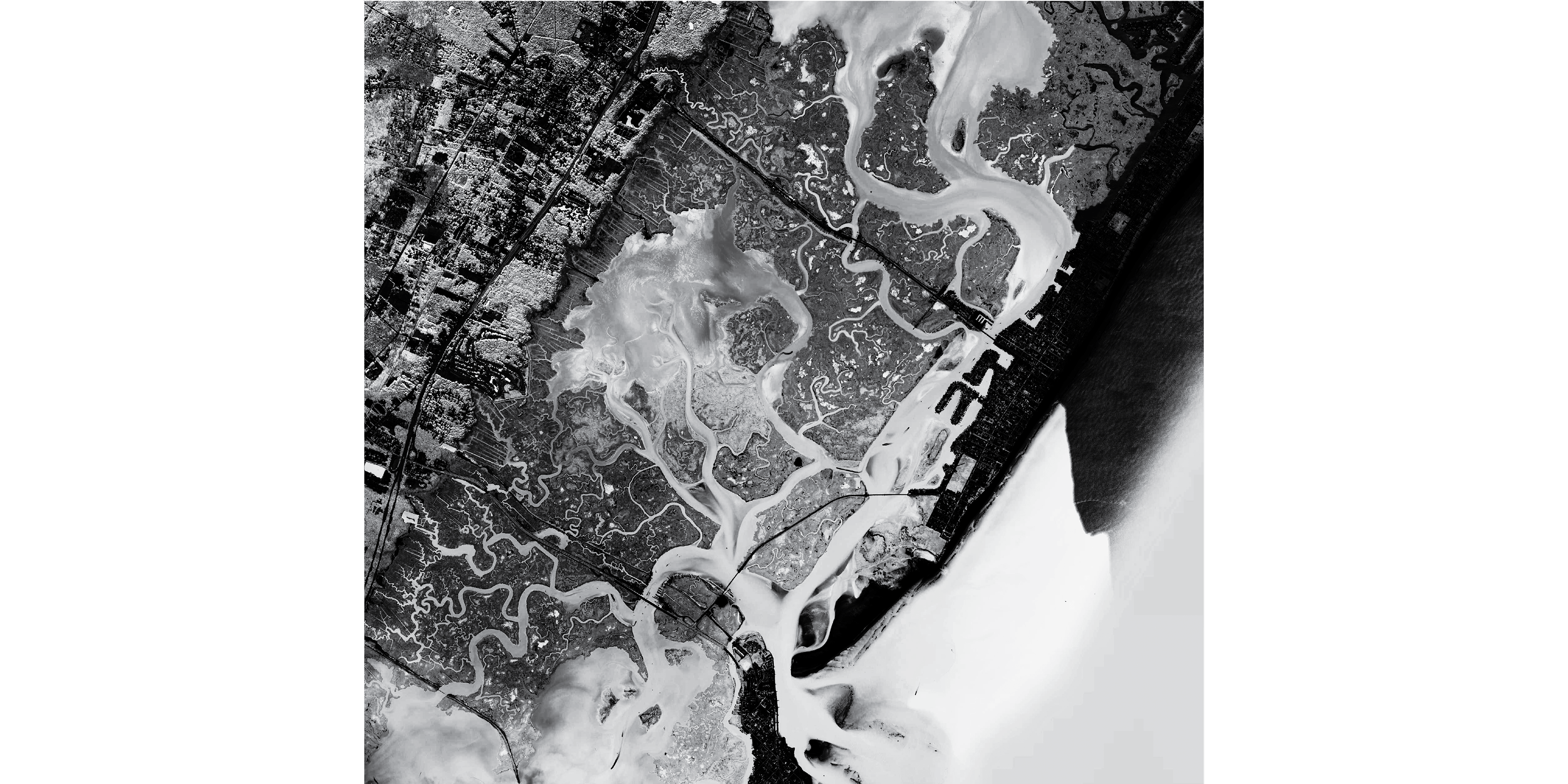
10-m panchromatic Landsat satellite image of the Jenkins Sound, NJ study area.
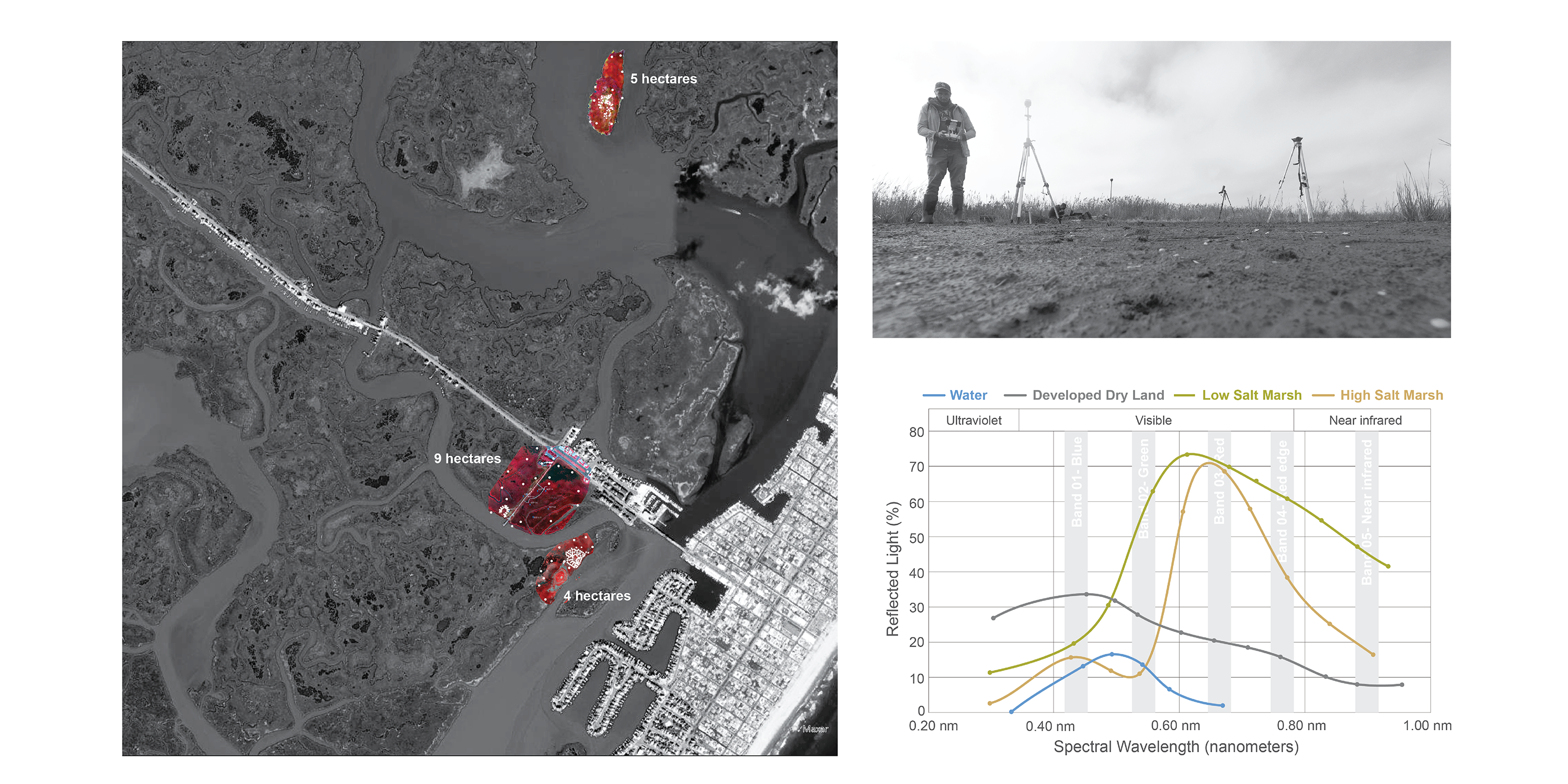
Satellite image of our study site with three of the four surveyed areas rendered in color infrared images that were collected with our UAV enabled multispectral camera. The inset chart shows the differences in the spectral wavelengths of the primary land cover classifications of concern: open water, developed land, low marsh (Spartina alterniflora) and high marsh (Spartina patens and Distichlis spicata).
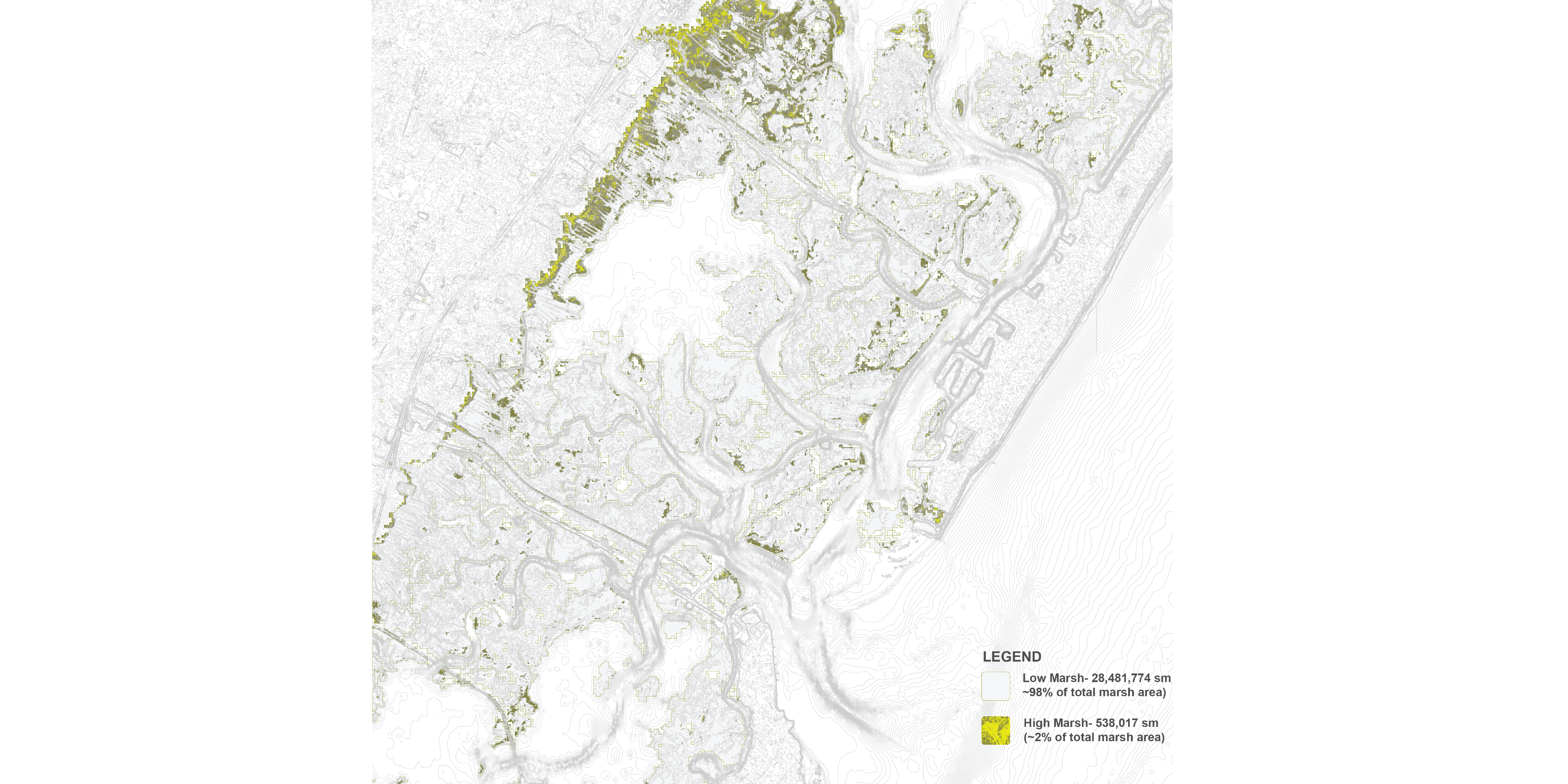
Resultant distribution of high marsh grasses in the Jenkins Sound, NJ study area.

Along with survey elevations, the UAV spectral wavelengths were used to locate zones of the high marsh grasses throughout the bay.
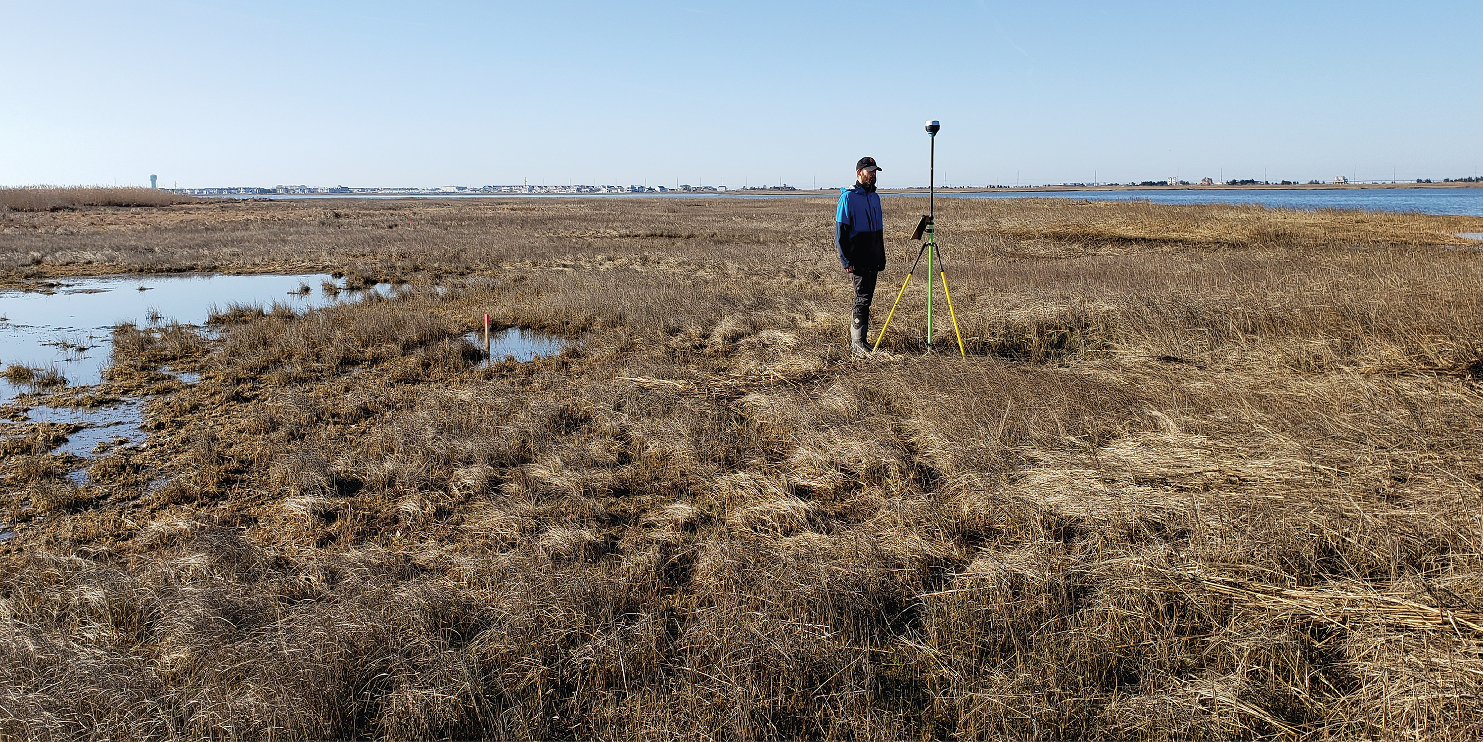
Field surveys of the four sites helped locate the typical elevation ranges of high marsh grasses.
Distichlis Sensing
Led By: Sean Burkholder, Karen M’Closkey and Keith VanDerSys
© 2020 University of Pennsylvania Stuart Weitzman School of Design
© The Ian L. McHarg Center for Urbanism and Ecology
210 South 34th Street
Philadelphia, PA 19104
© 2020 University of Pennsylvania Stuart Weitzman School of Design
© The Ian L. McHarg Center for Urbanism and Ecology
Office of the Director
210 South 34th Street
Philadelphia, PA 19104