Teaching
Simulating Natures
This seminar explores the value and potential of computer-aided analysis, simulation, and design in landscape architecture. Computation has greatly expanded the means by which designers can engage the temporal and relational qualities inherent to the dynamic medium of landscape. Students engage in combining the computational capacities of geospatial analysis (GIS), computational fluid dynamics (Aquaveo SRH-2d, SLOSH, Rhino CFD), and parametric software (Grasshopper) to investigate new modes of defining, articulating, and reorganizing vacant sites along the banks of the Delaware River. Demonstrations of the essential tools and techniques are presented and discussed throughout the semester, along with relevant project examples, readings, and guest lecturers.
Sensing & Sensibilities: Arduinos, Drones, & Satellites
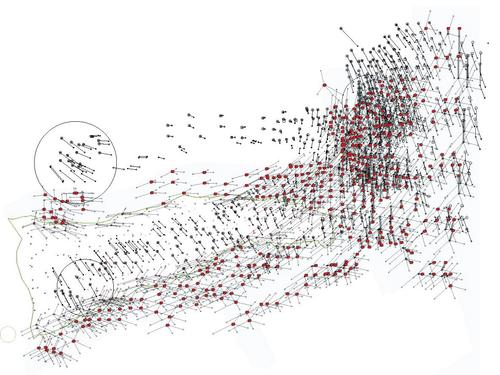
Low cost, simple-to-use surveying and sensing equipment are increasingly available to designers. Imagining technologies form our primary means of translating and expressing our environment. Yet, sensing and syncing data collected across scales, however, remains cumbersome. Through hands-on field collection exercises and in-class demos, students will be introduced to an array of sensing tools that are central to collecting and analyzing environmental changes across scales: Arduino sensors; Unmanned Aerial Vehicles (aka drones); RTK GPS receivers; and image recognition software. This technology and representation seminar is taught collaboratively; the primary instructor will participate in all modules.
Baywatch: Mediated Environments
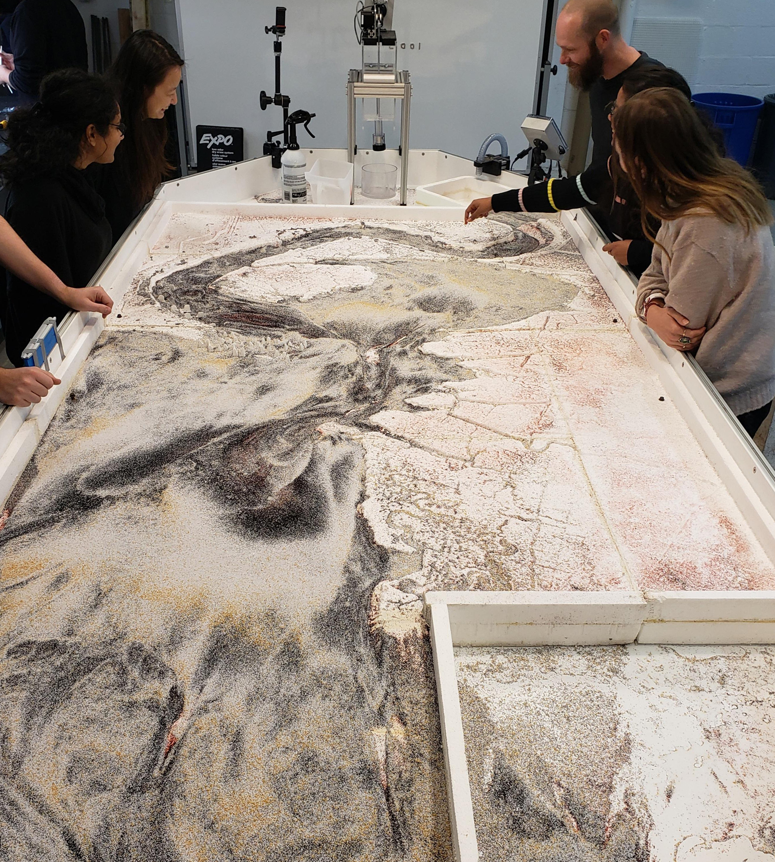
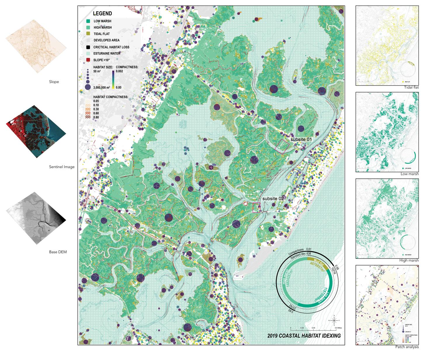
Put succinctly, this course is about modeling the dynamics between land and water. The Delaware estuary is an unparalleled economic and ecological resource to our region. Yet the lives it sustains, human or otherwise, are increasing imperiled by human-induced alterations that have negatively impacted its ever-changing dynamics. While landscape architects may make claims to coastal resiliency expertise, they know little about the environmental information and modeling that forms the foundations in which estuarine dynamics are conceived, projected, and managed. As such, this course will introduce students to the practical and speculative opportunities afforded through data collection and modeling of hydrological processes, both computationally and physically. Through hands-on field collection exercises and in-class demos, students will be introduced to an array of sensing and modeling tools such as unmanned aerial vehicles (UAV); GPS survey receivers; hydrodynamic simulation modeling (SRH-2d/ SLAMM); and physical fluid modeling.
In addition to on-site collection trips and software demos, the seminar will be supplemented with readings and discussions around theories of “media ecology” as a method to conceptually ground the work beyond a simple fascination with landscape metrics. The seminar will also partner with local and federal representatives who are currently working on the coastal wetlands in New Jersey.
© 2020 University of Pennsylvania Stuart Weitzman School of Design
© The Ian L. McHarg Center for Urbanism and Ecology
210 South 34th Street
Philadelphia, PA 19104
© 2020 University of Pennsylvania Stuart Weitzman School of Design
© The Ian L. McHarg Center for Urbanism and Ecology
Office of the Director
210 South 34th Street
Philadelphia, PA 19104