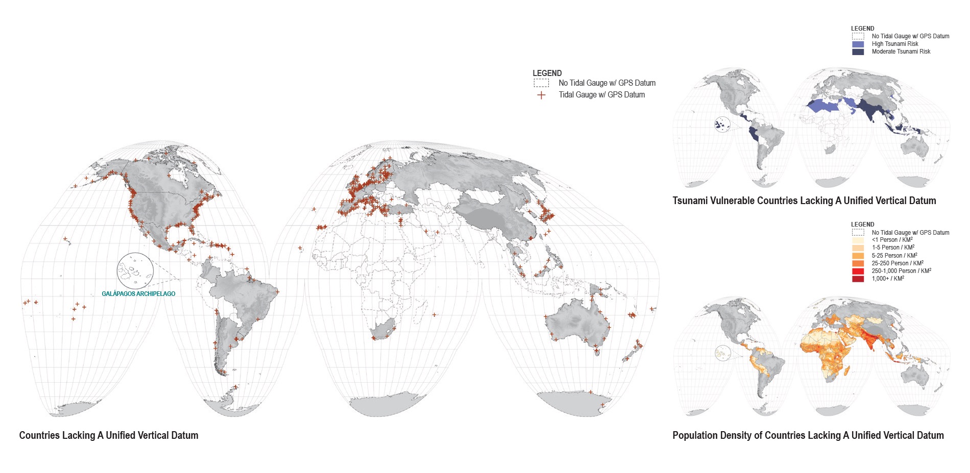
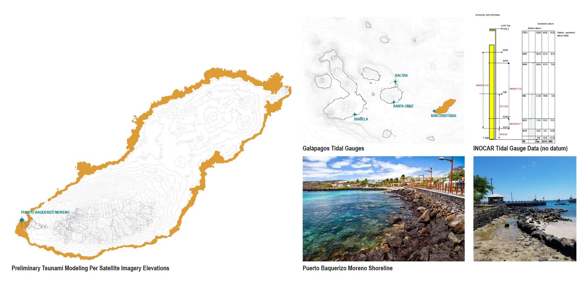
These maps show countries that do not have a unified vertical datum to match water elevations relative to land.

The Galápagos Islands is also missing a unified vertical datum for its tide gauges.
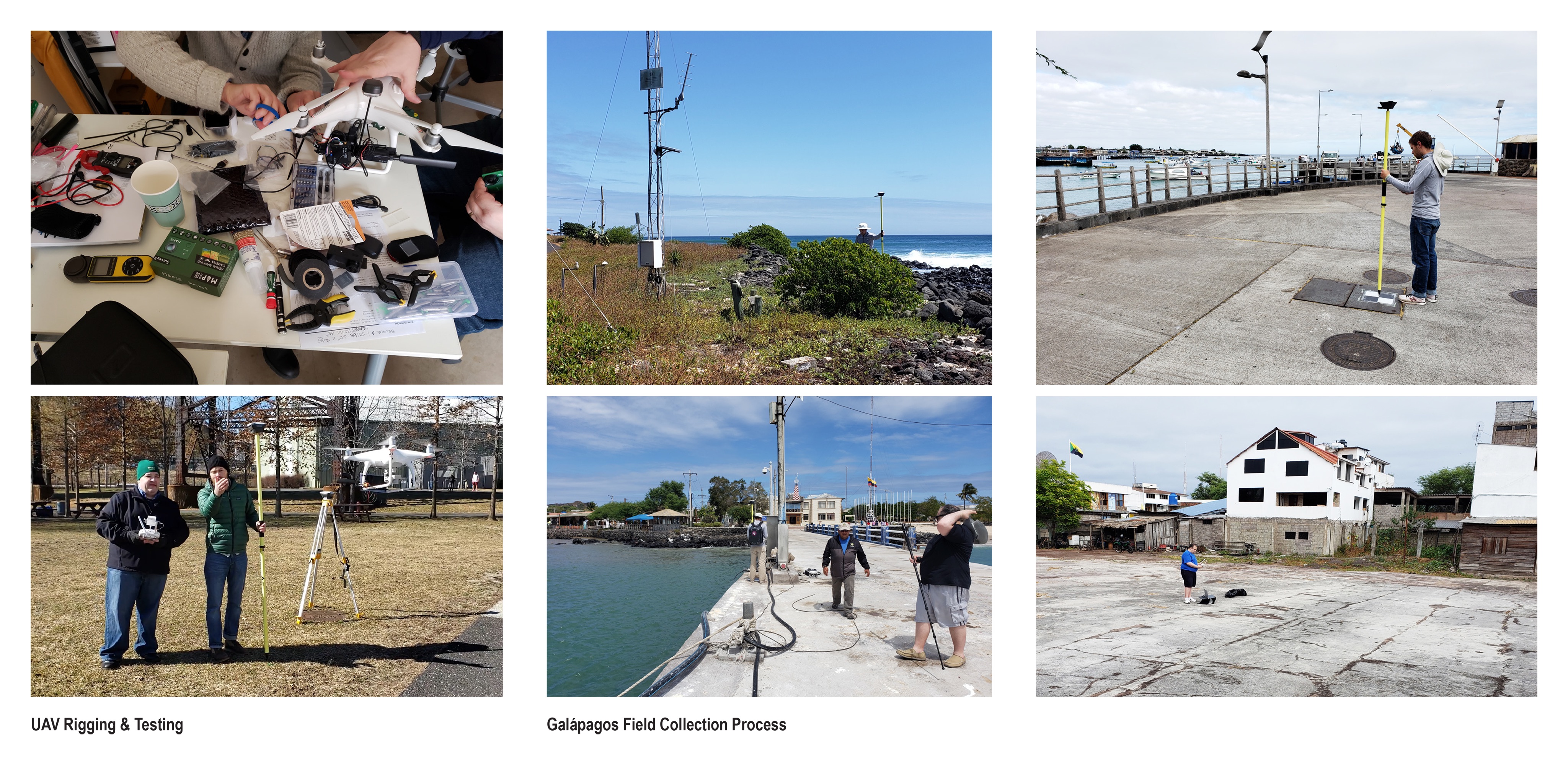
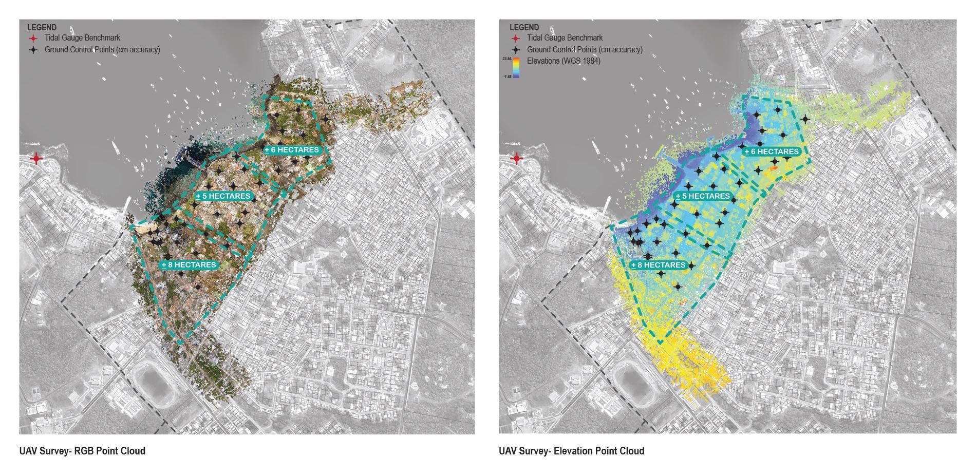
Our team used UAVs (drones) and GPS/ GNSS site survey equipment to record aerial survey information of Puerto Baquerizo Moreno’s shoreline and ravines.

Over a four-day period, our team collected approximately 20 hectares of high accuracy, high resolution survey data, including the tide gauge location and elevation.
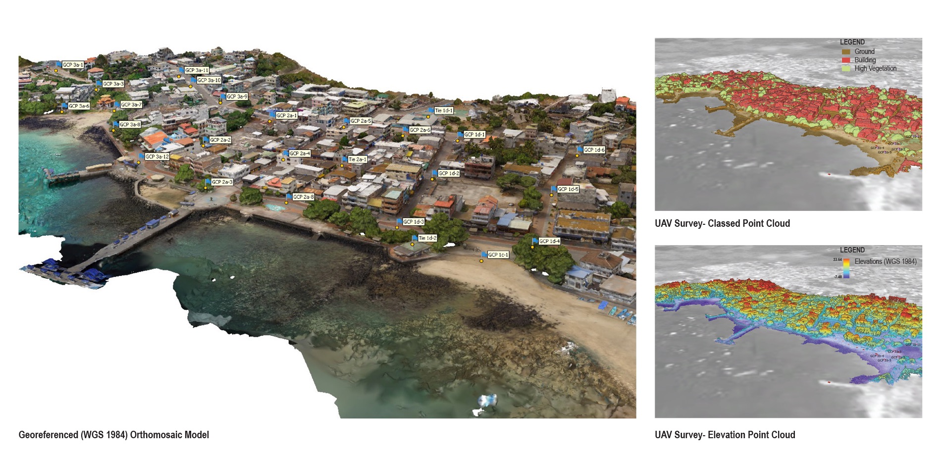
Through our survey work, tidal elevations can now be measured relative to land. This will enable INOCAR to more accurately assess past and future tides and storms.
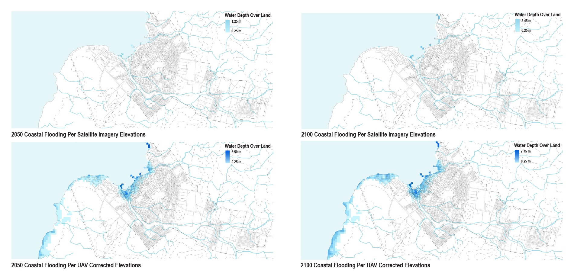
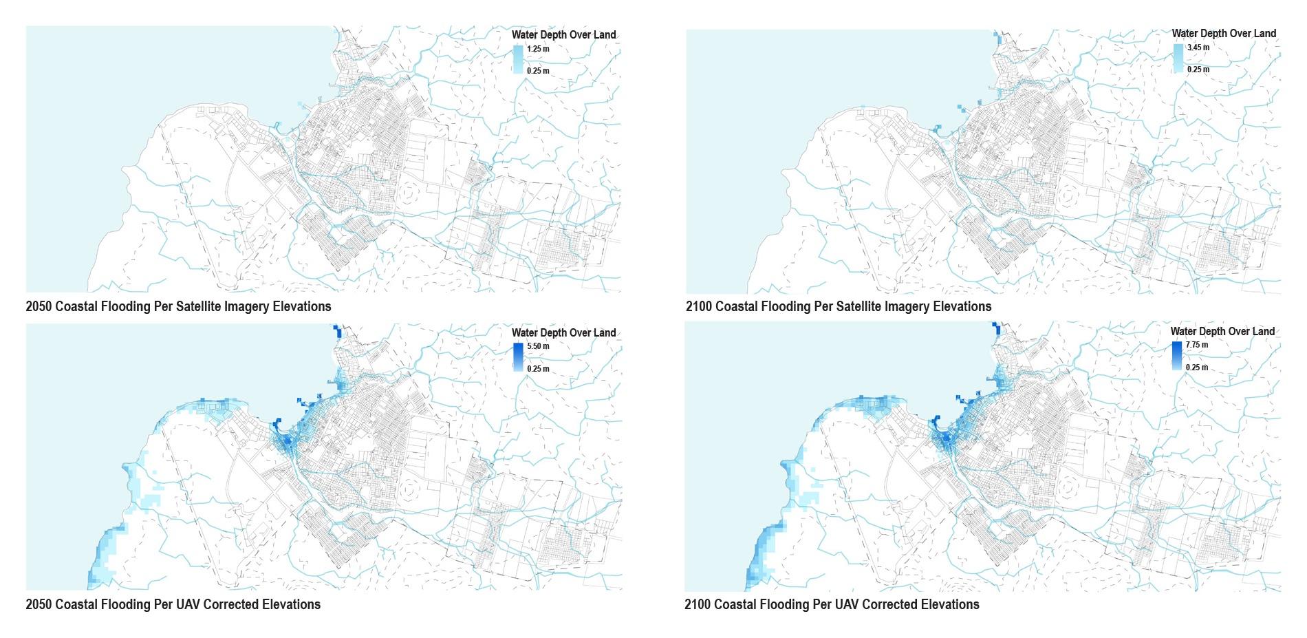
The height of San Cristóbal’s terrain is presently calculated through satellite imagery (top). When corrected with our survey data (bottom), the extent of possible future storm surge over land is much higher than if modeled with satellite elevation data.


Galapagos UAV Mapping
Led By: Karen M’Closkey and Keith VanDerSys
Team: Michael Luegering and Michael Tantala
Aerial Overview
© 2020 University of Pennsylvania Stuart Weitzman School of Design
© The Ian L. McHarg Center for Urbanism and Ecology
210 South 34th Street
Philadelphia, PA 19104
© 2020 University of Pennsylvania Stuart Weitzman School of Design
© The Ian L. McHarg Center for Urbanism and Ecology
Office of the Director
210 South 34th Street
Philadelphia, PA 19104