
Aerial imagery of the dredge placement process to help elevate the marsh against losses due to rising sea levels.
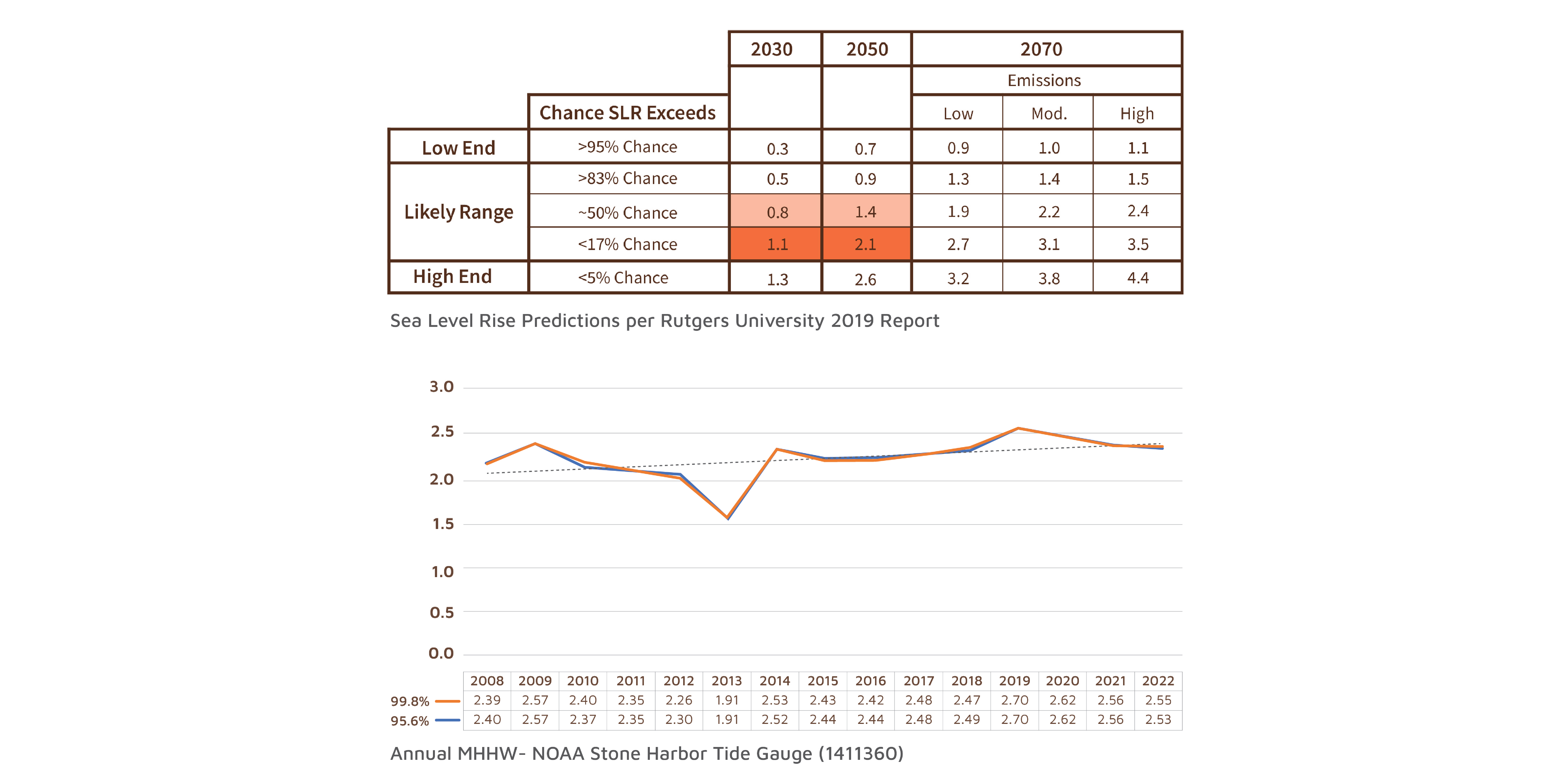
The inputs for mid-term sea level rise were taken from Rutgers' 2019 “New Jersey’s Rising Seas and Coastal Storms” report. Bay-wide water elevation changes were also derived from gauge data over a 14-year timeframe.
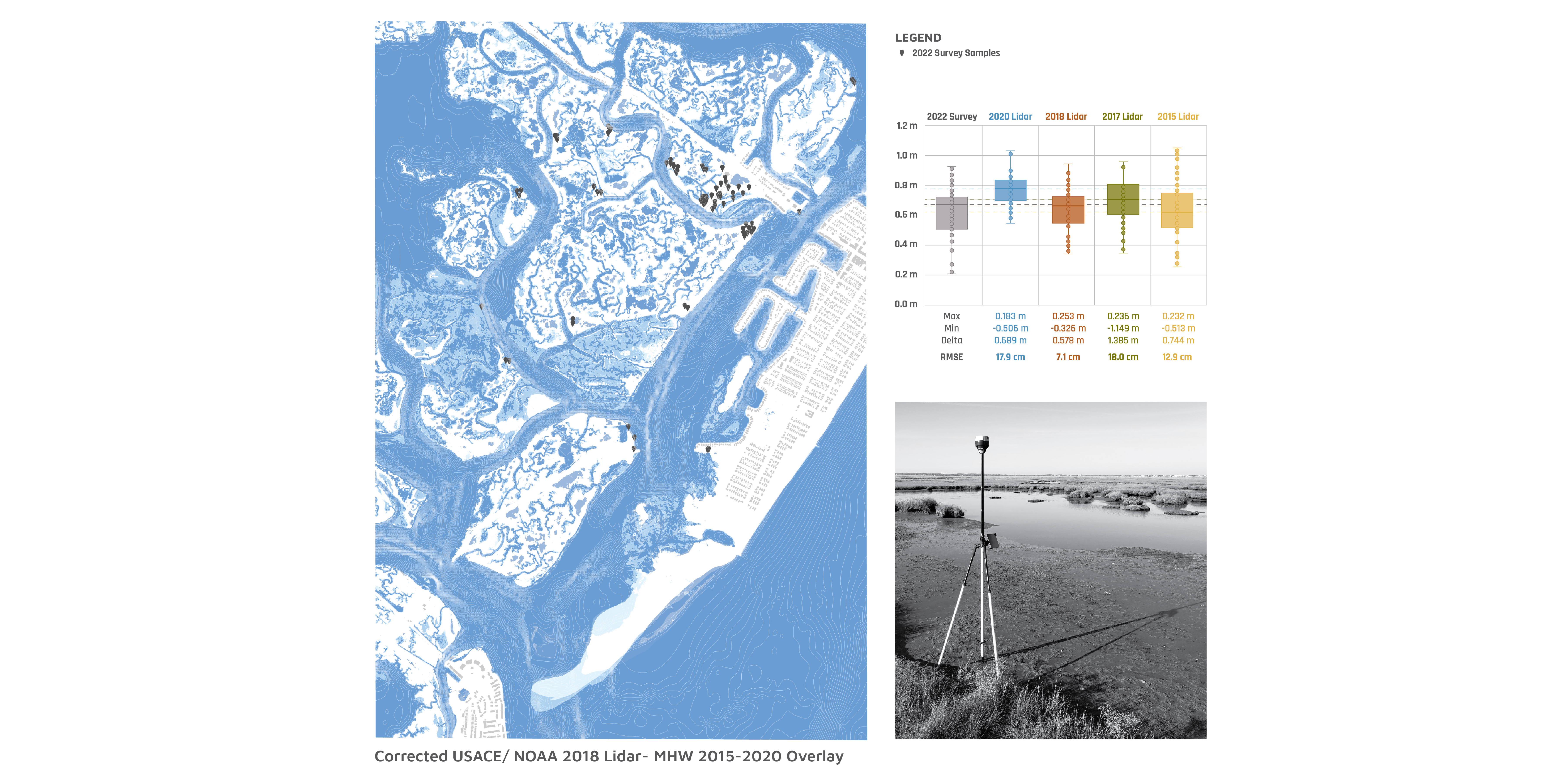
The lab used field surveys to verify and correct existing lidar-derived DEM elevations. Existing aerial-based elevation data for salt marshes typically have a high degree of uncertainty in elevation measurements.
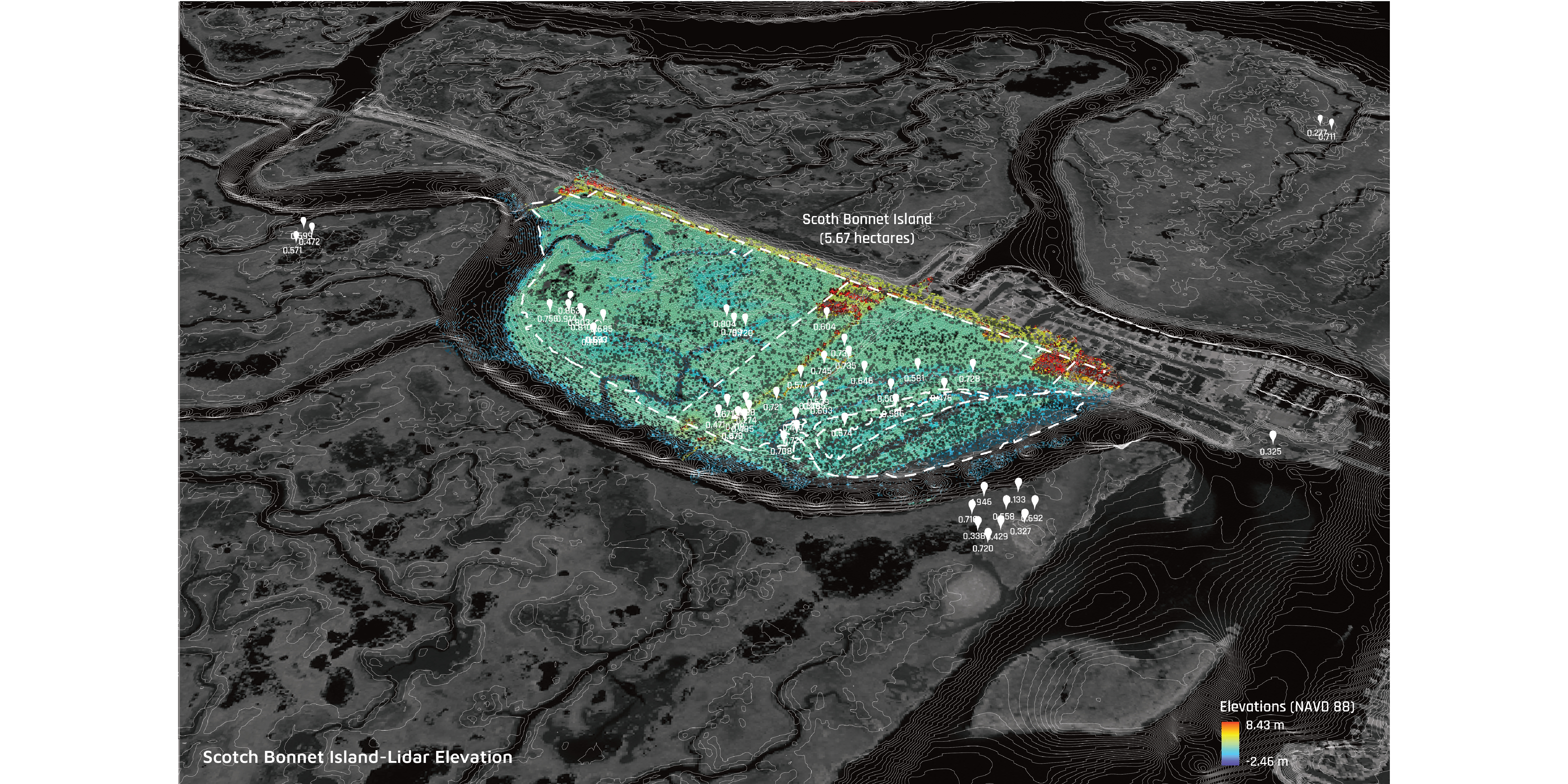
Three-dimensional model of the phase one wetland restoration area on Scotch Bonnet Island.
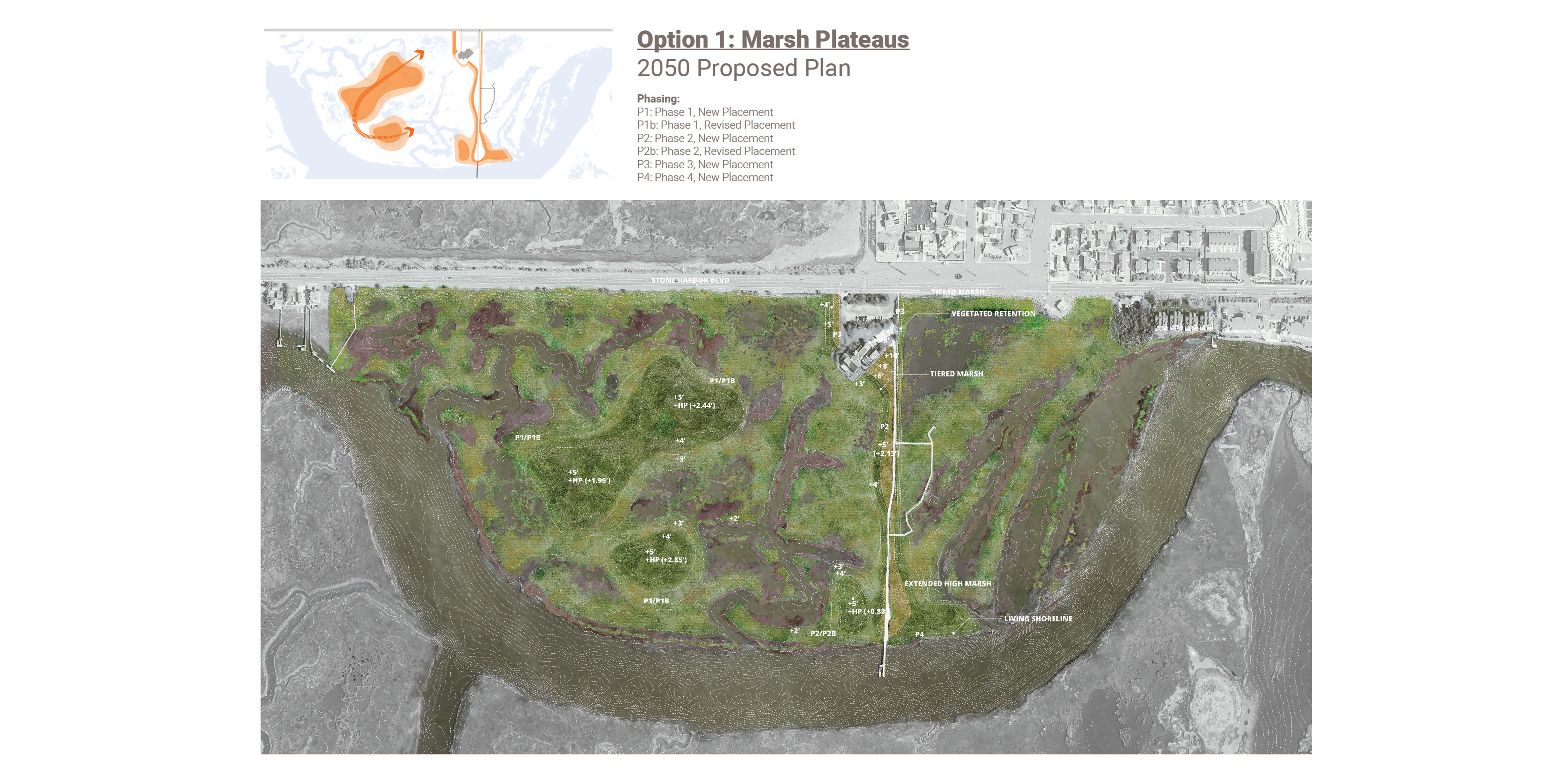
Conceptual marsh placement and nature-based storm protection Option 1.

SLAMM model simulation and aerial collage showing the projected land cover changes in 2030, assuming 2.1 ft of sea level rise.

SLAMM model simulation and aerial collage showing the projected land cover changes in 2050, assuming 2.1 ft of sea level rise.

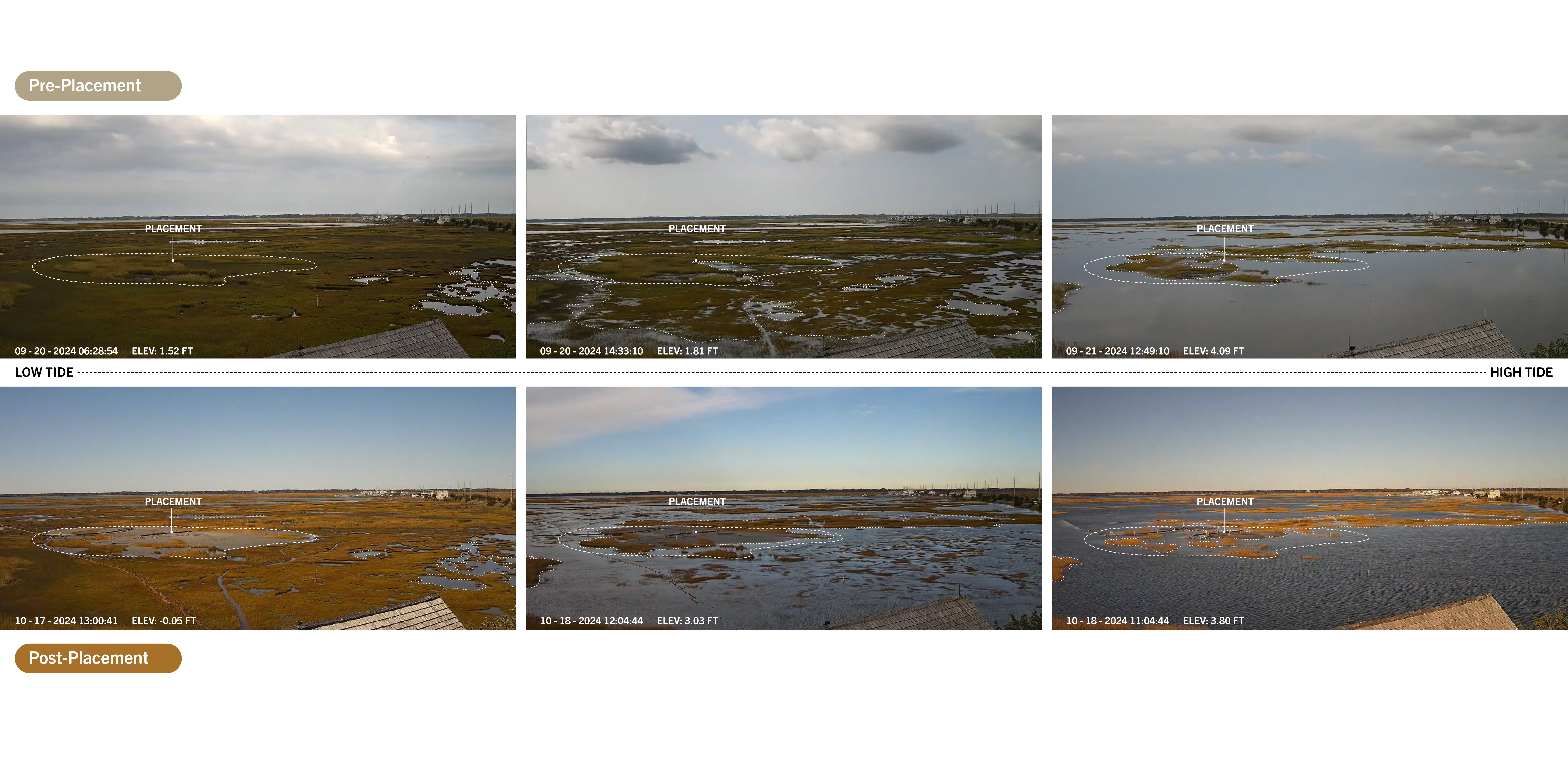
Photos from The Wetlands Institute of the placement site pre-placement and post-placement, accross varying tide levels.

Jenkins Sound Resiliency Plan
The EMLab is working with The Wetlands Institute (TWI) and New Jersey Department of Environmental Protection (NJDEP) to develop a multi-phase resiliency plan to help preserve and protect valuable marsh habitats in the greater Jenkins Sound area. The initial phase of this study involves data collection, cultural assessment, and simulation modeling for the bay area. Initial implementation plans include sediment placement and nature-based infrastructure improvements for the Scotch Bonnet Island area.
Partners for this phase of work also include the U.S. Army Corps of Engineers, Philadelphia District.
Led By: Keith VanDerSys and Sean Burkholder
Sediment Placement Monitoring
This timelapse shows the increased marshland elevation produced by the placement of dredged material at high tide. Adequate elevation is essential for the survival of marsh grasses and the wildlife habitats that they provide. The EMLab team will be monitoring the impact of the placement through collecting multi-spectral imagery over the next 3 years.
© 2020 University of Pennsylvania Stuart Weitzman School of Design
© The Ian L. McHarg Center for Urbanism and Ecology
210 South 34th Street
Philadelphia, PA 19104
© 2020 University of Pennsylvania Stuart Weitzman School of Design
© The Ian L. McHarg Center for Urbanism and Ecology
Office of the Director
210 South 34th Street
Philadelphia, PA 19104