![]()
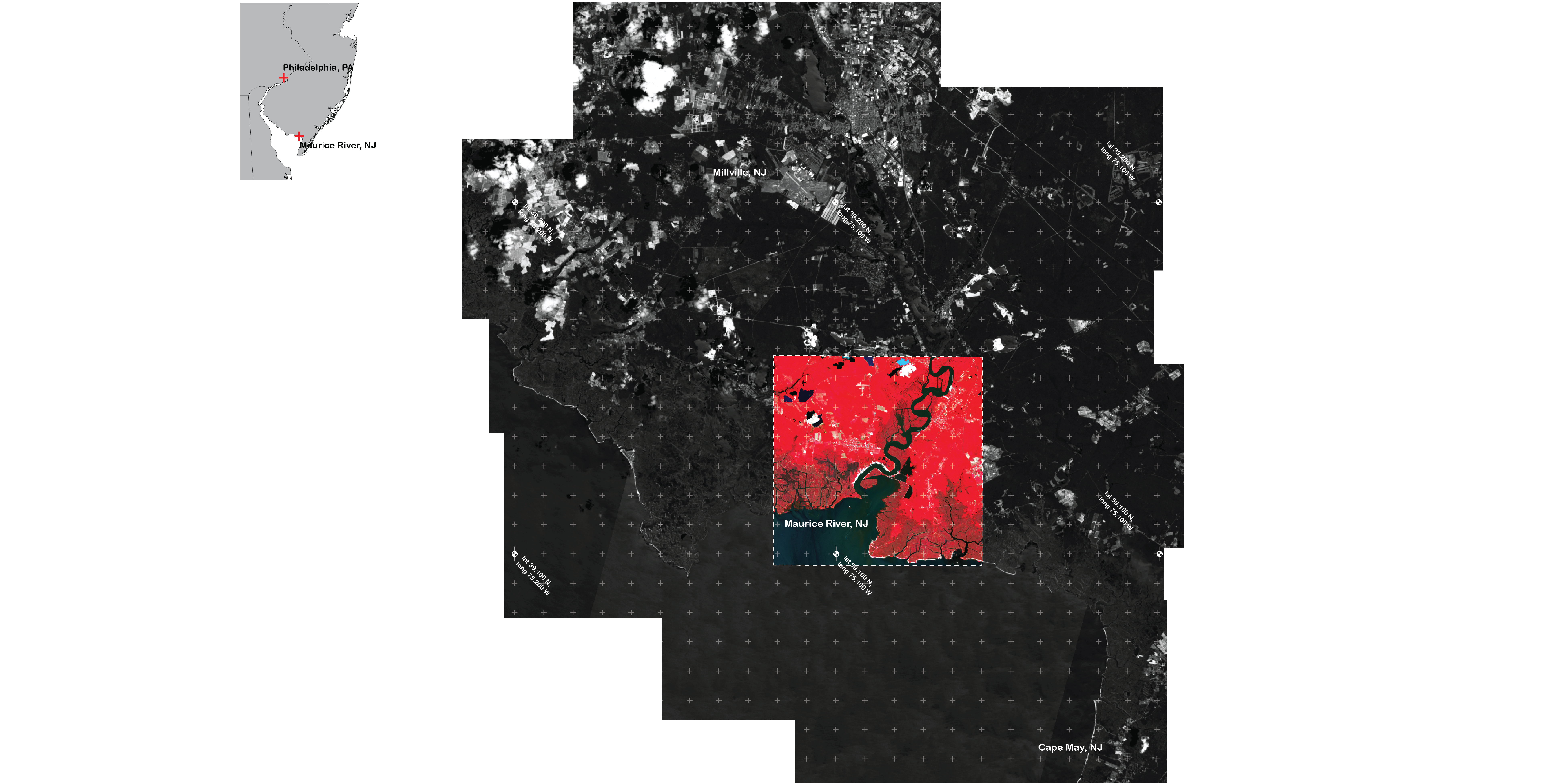
A color infrared satellite composite image of the project site along the Maurice River bay area.
![]()
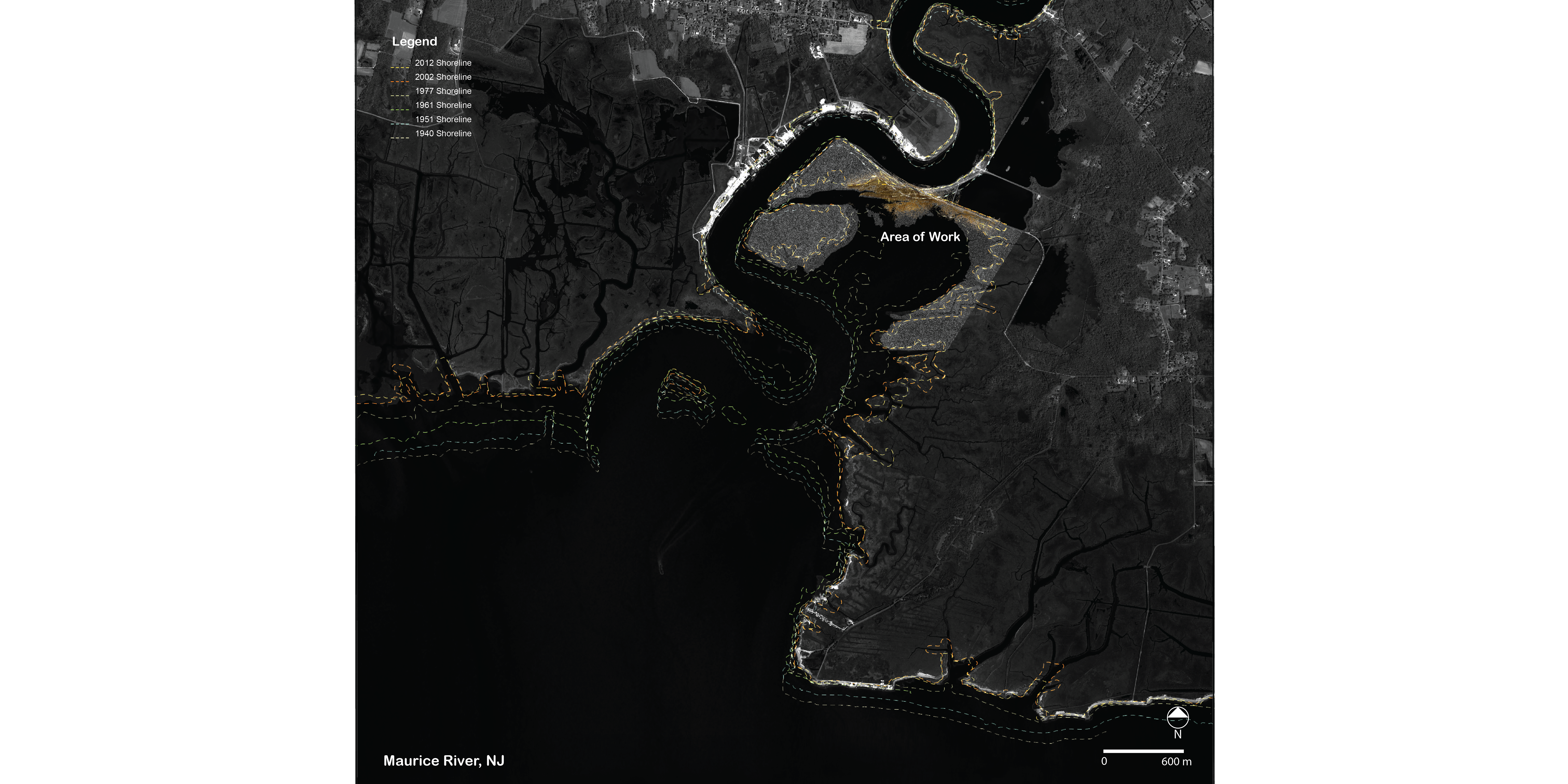
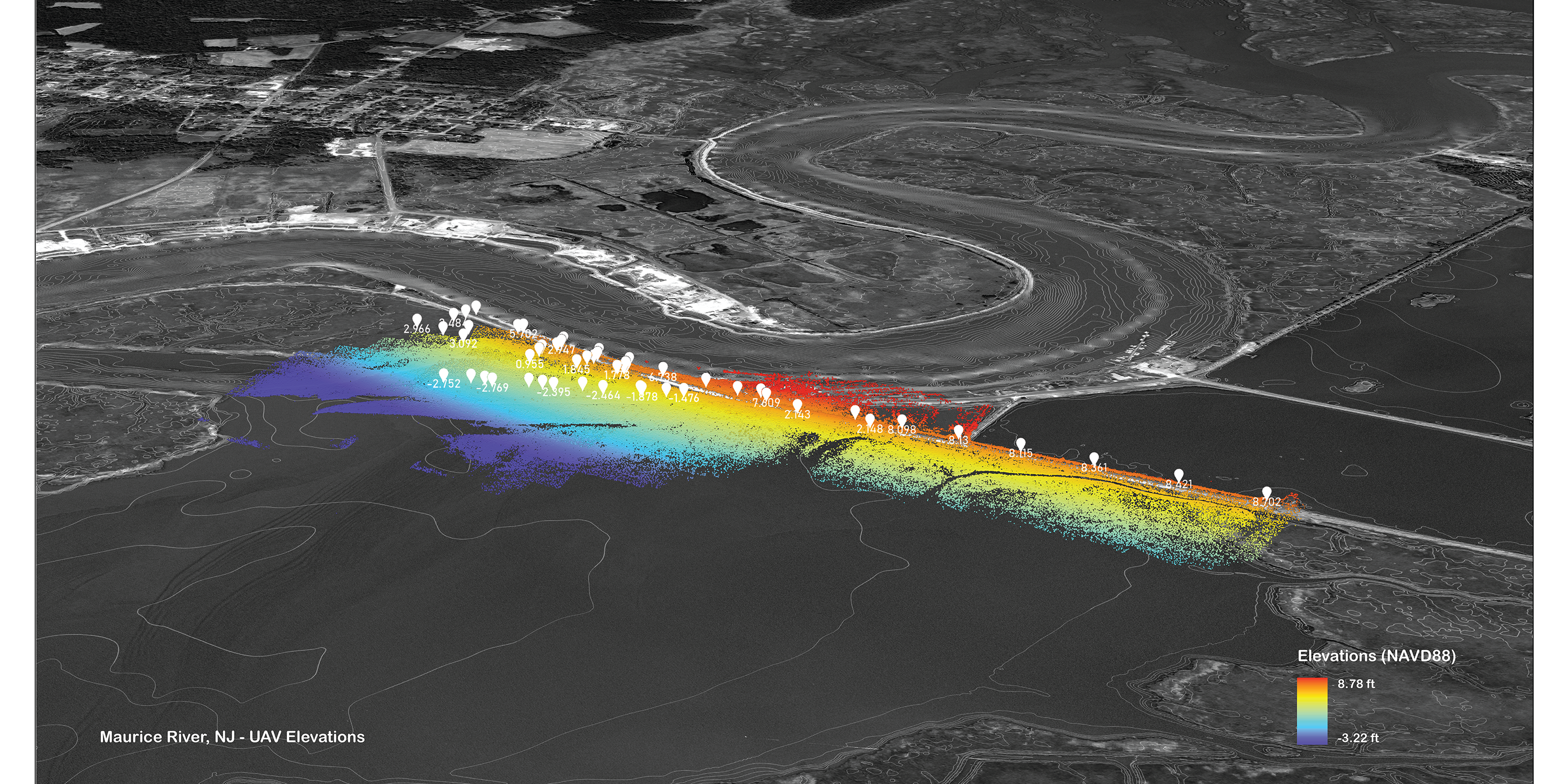
UAV elevation and USACE lidar data composite of the project area. Historic research shows the marsh loss since the early 20th century.
![]()
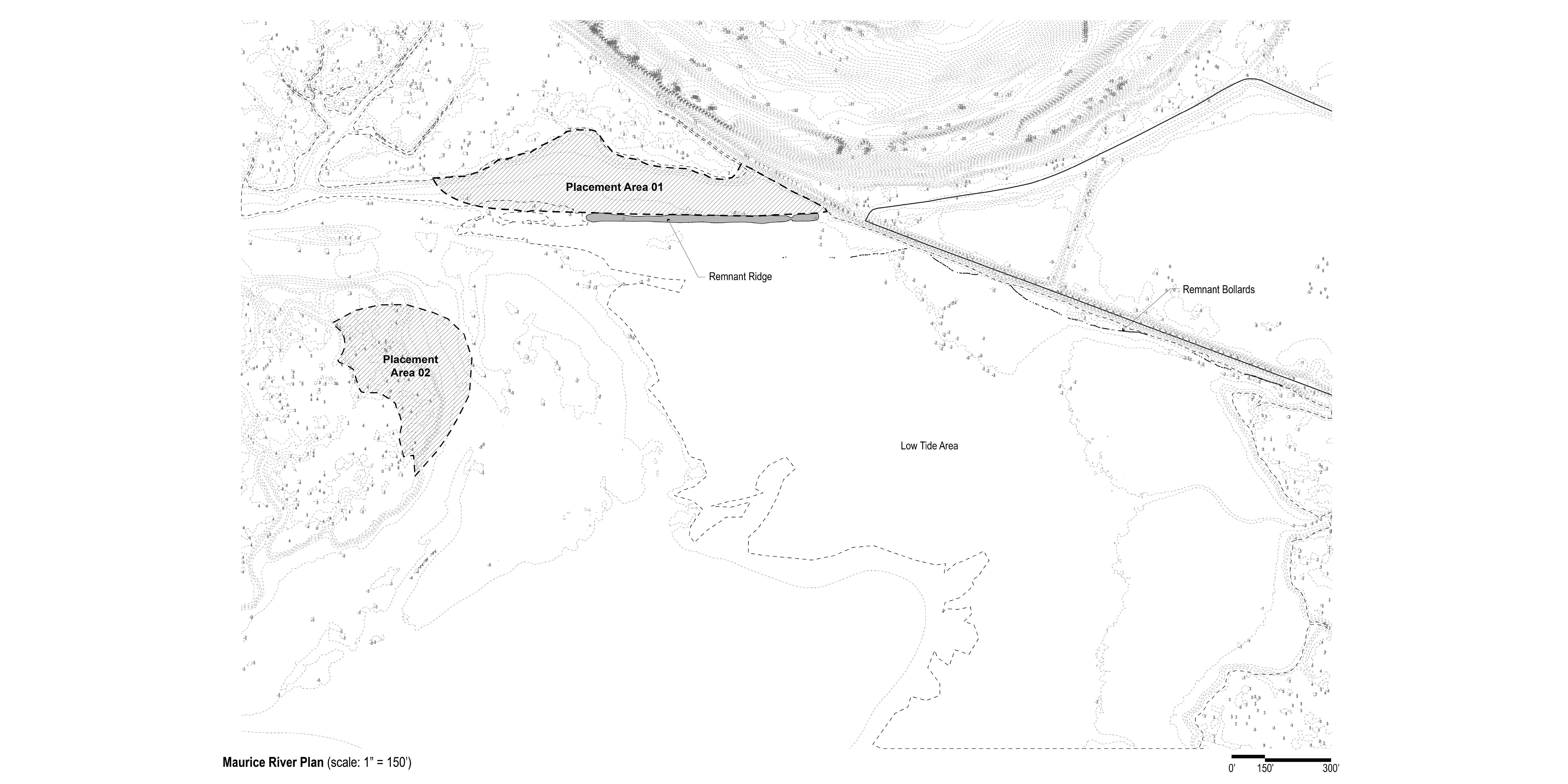
Plan of initial sediment placement areas to restore parts of the adjacent marsh that helps protect the Heislerville dike.
![]()
A historic rail line once ran through the bay. A remnant ridge of its previous path will provide a stable support in which to anchor the floating sediment curtains.
![]()
Three-dimensional model of existing placement dike and planned placement areas. Existing elevation and vegetation assessment will be important for gauging changes of the sediment post-placement.
![]()
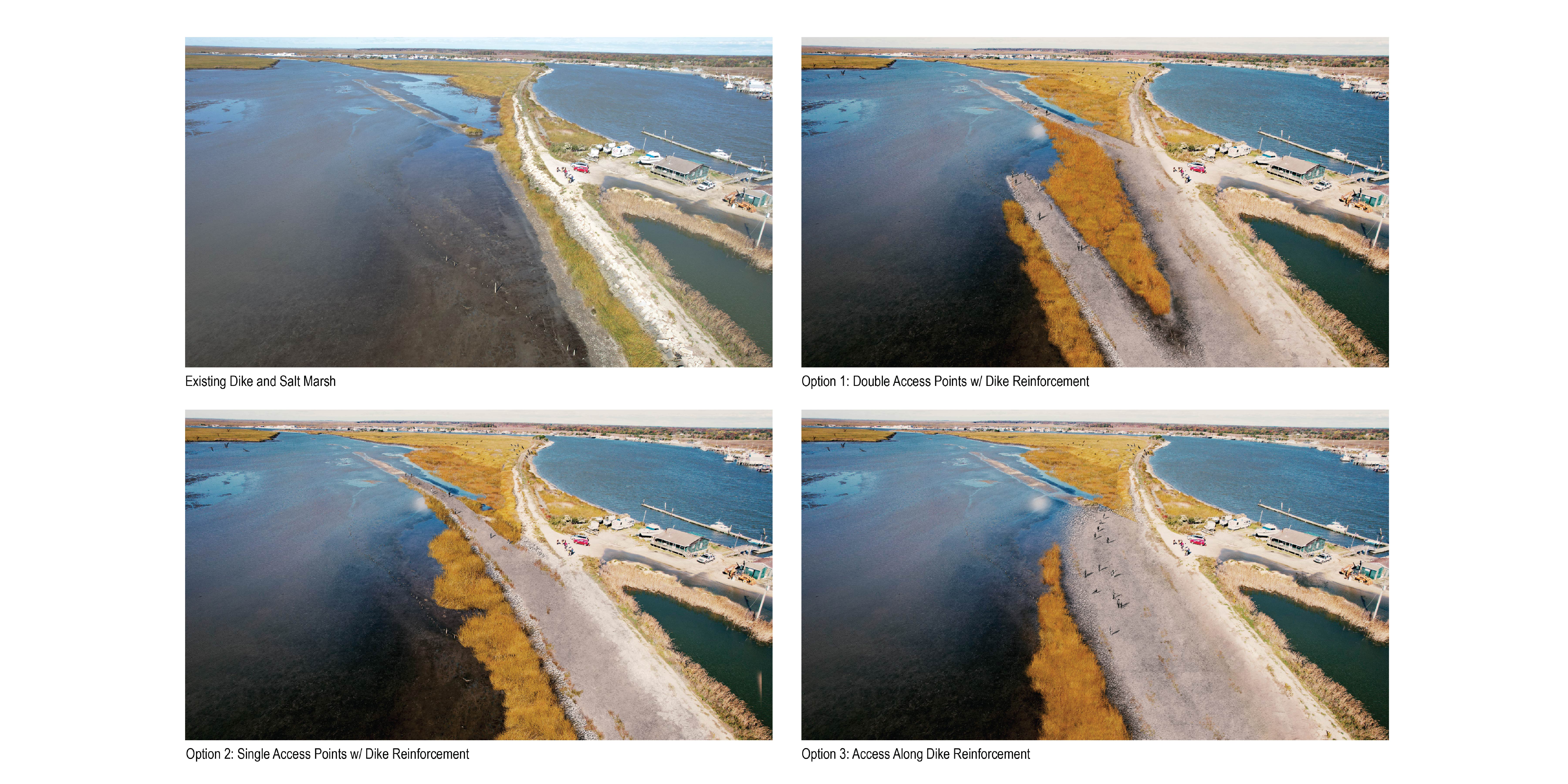
Design options for Matts Landing dike reinforcement to expand and enhance salt marsh access
![]()
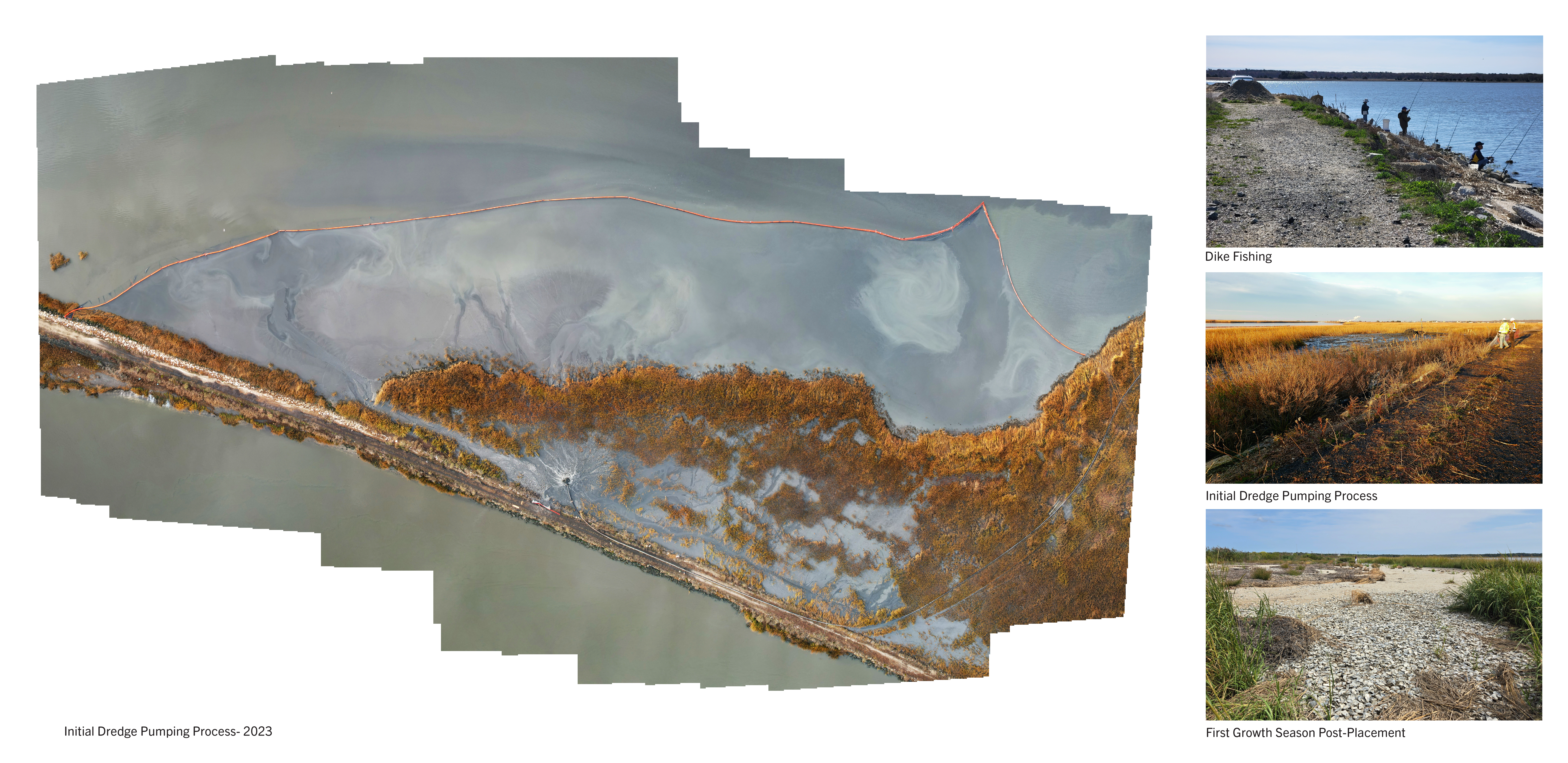
Images of dredge placement to increase marsh elevation against losses due to rising sea levels
![]()
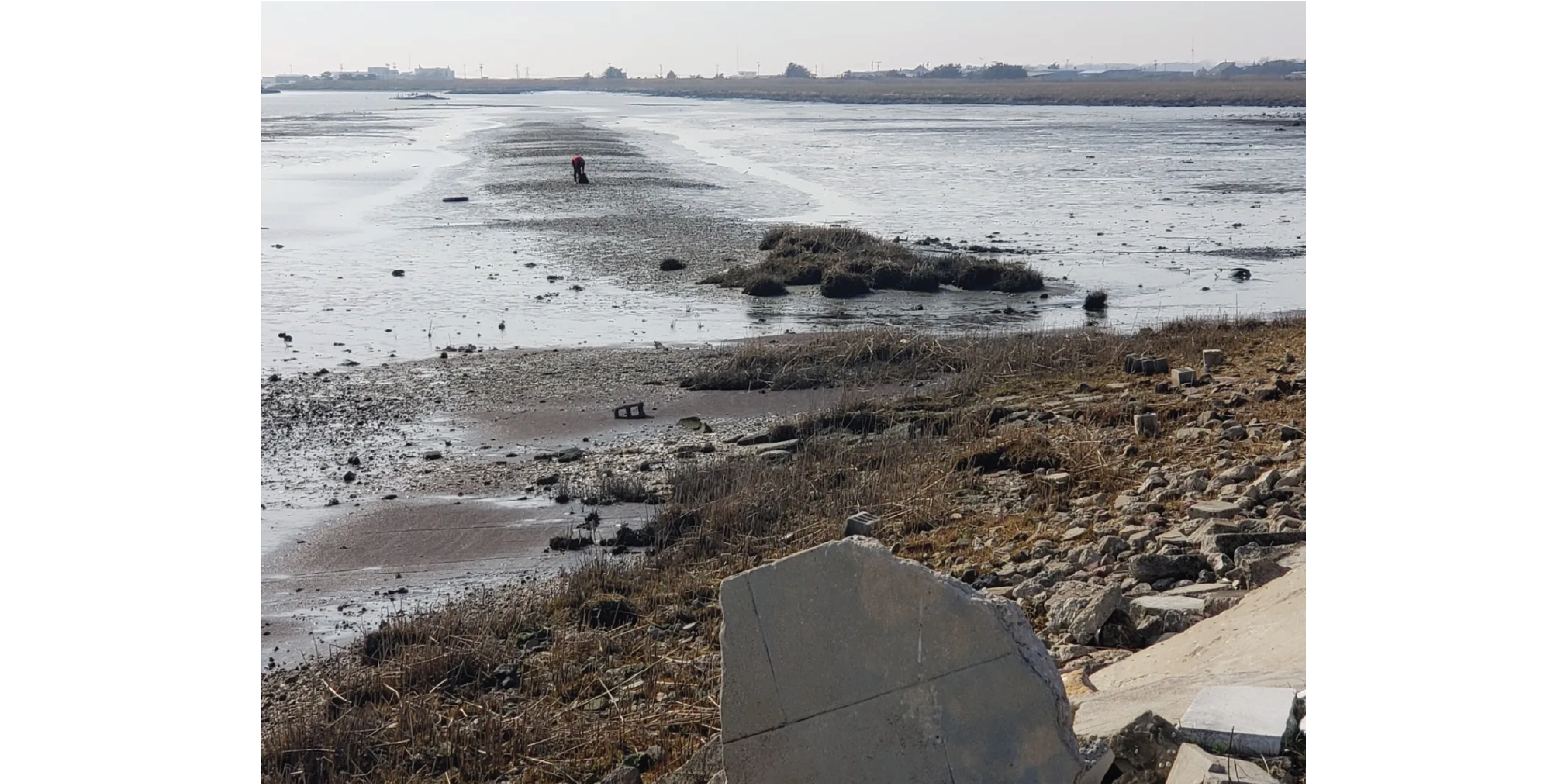
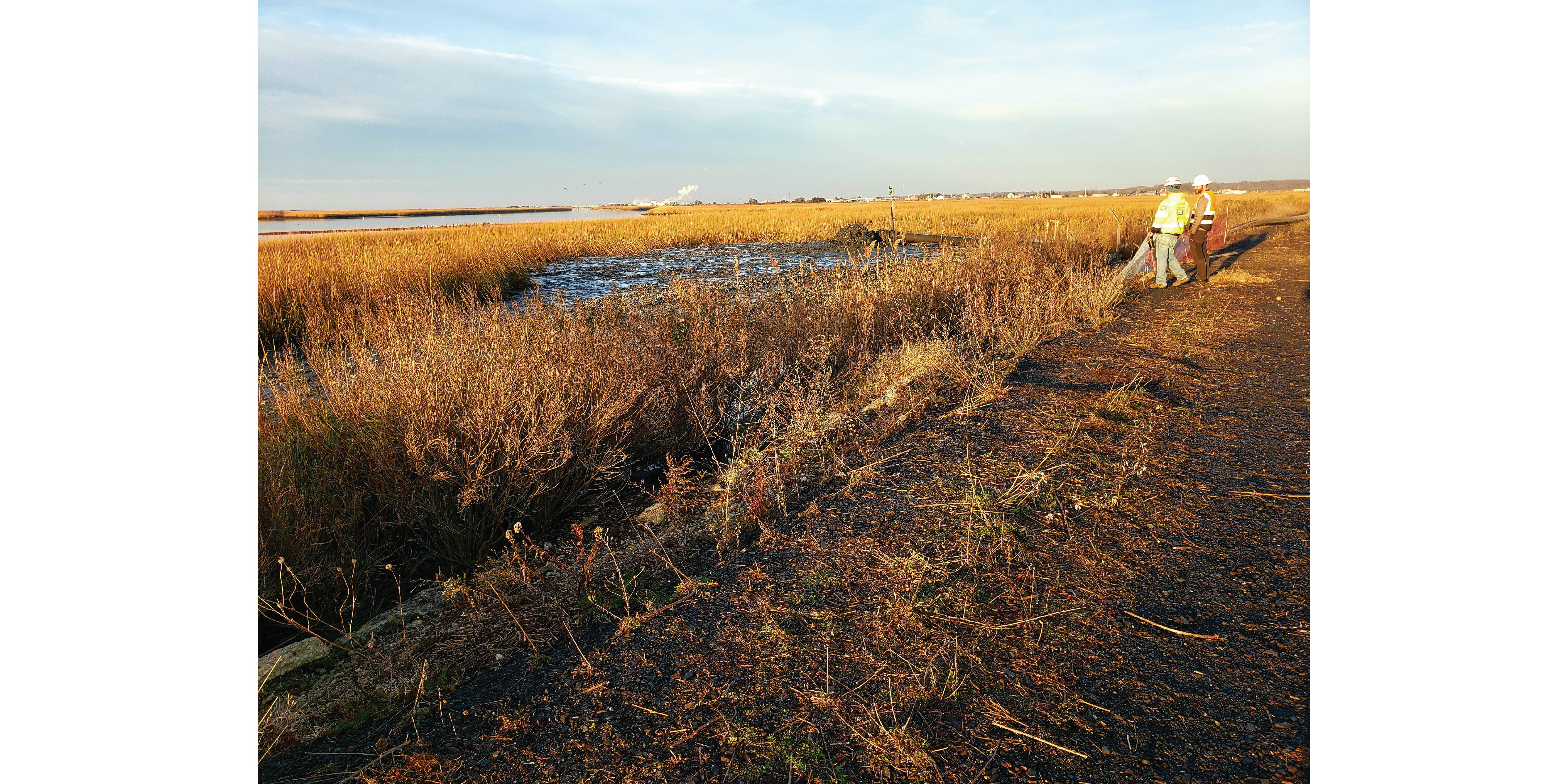
Field pic of initial dredge pumping in progress
Maurice River
The Maurice River is a critical navigation corridor and resource for a group of estuarine communities with a rich fishing and oyster harvesting heritage. The river, however, has not been dredged since the 1990s and is in a critical state of requiring dredging to resolve navigation impediments at the mouth of the river. In lieu of the wasteful and costly practice of trucking the material to an offsite containment facility, the dredged material will be placed in areas adjacent to the mouth of the river to supplement coastal mudflat and augment marsh elevation to help protect the communities situated between the riverbank and degrading coastal marsh.
The dredged materials will be placed by USACE Philadelphia District (NAP), Operations Division within the State of New Jersey’s Heislerville Management Wildlife Management Area, an environmentally sensitive area. To optimize sediment placement and monitoring ongoing performance, our team is assisting in research, design, and in-field data collection. Beneficial use of dredge materials, however, is still an experimental practice and the processes of reestablishing intended ecosystem benefits (e.g., flood/storm protection, habitat, etc.) takes time and is poorly understood. After placement in fall 2022, our team will therefore provide post-placement monitoring to evaluate the ongoing ecological and morphological dynamics of the marsh.
Led By: Sean Burkholder,
Karen M’Closkey and Keith VanDerSys


