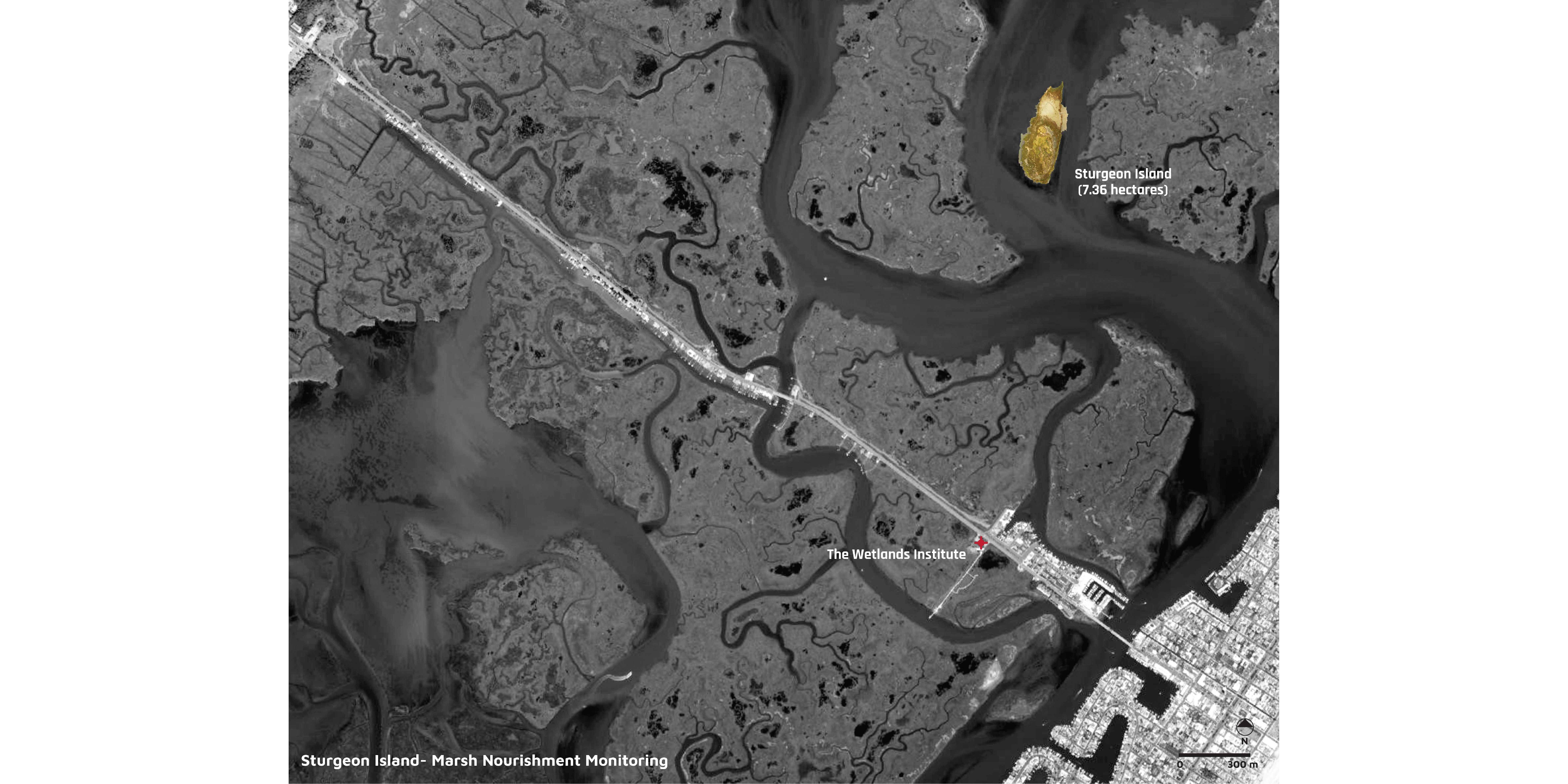
Sturgeon Island is an experimental marsh nourishment site.
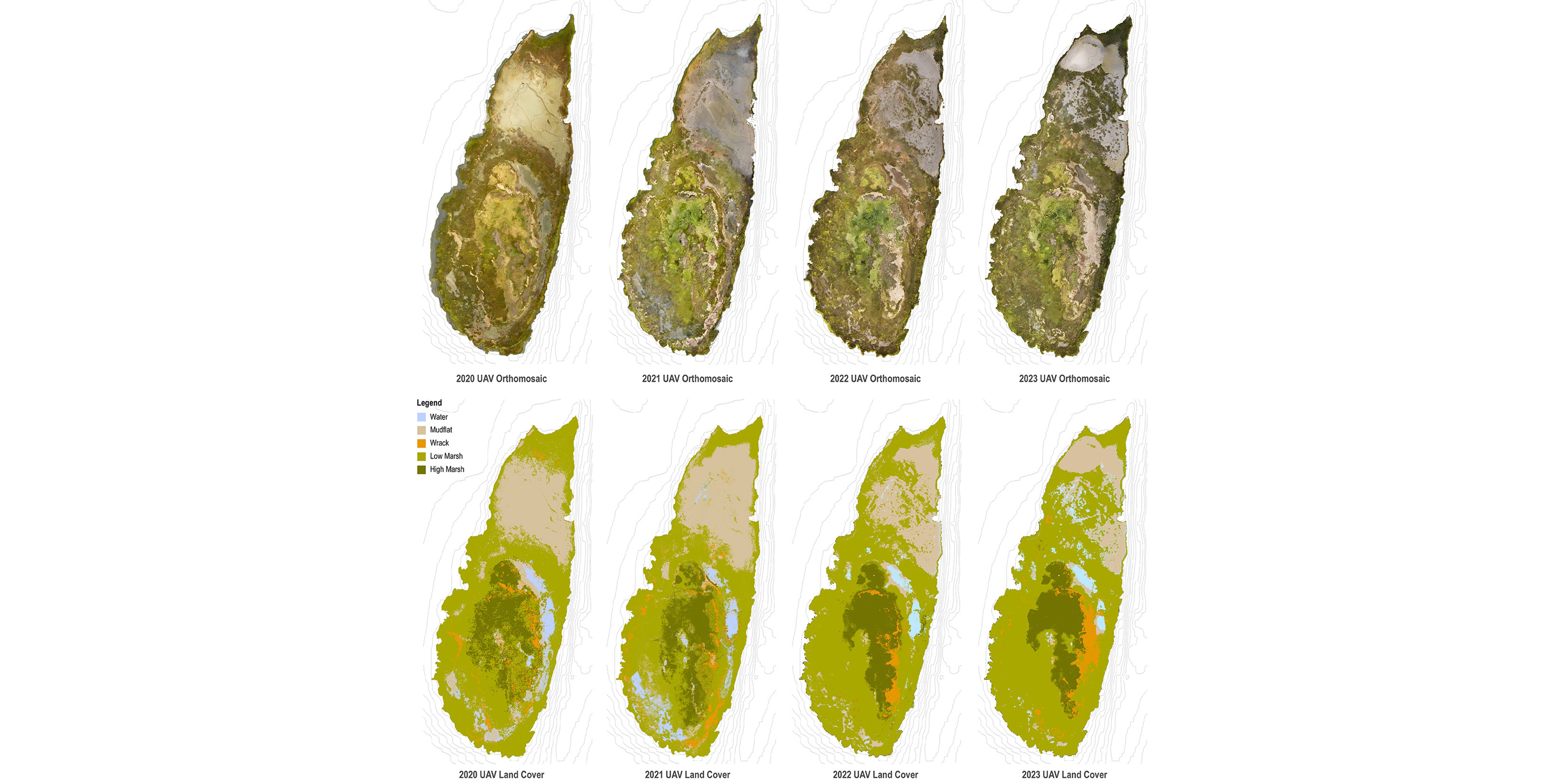
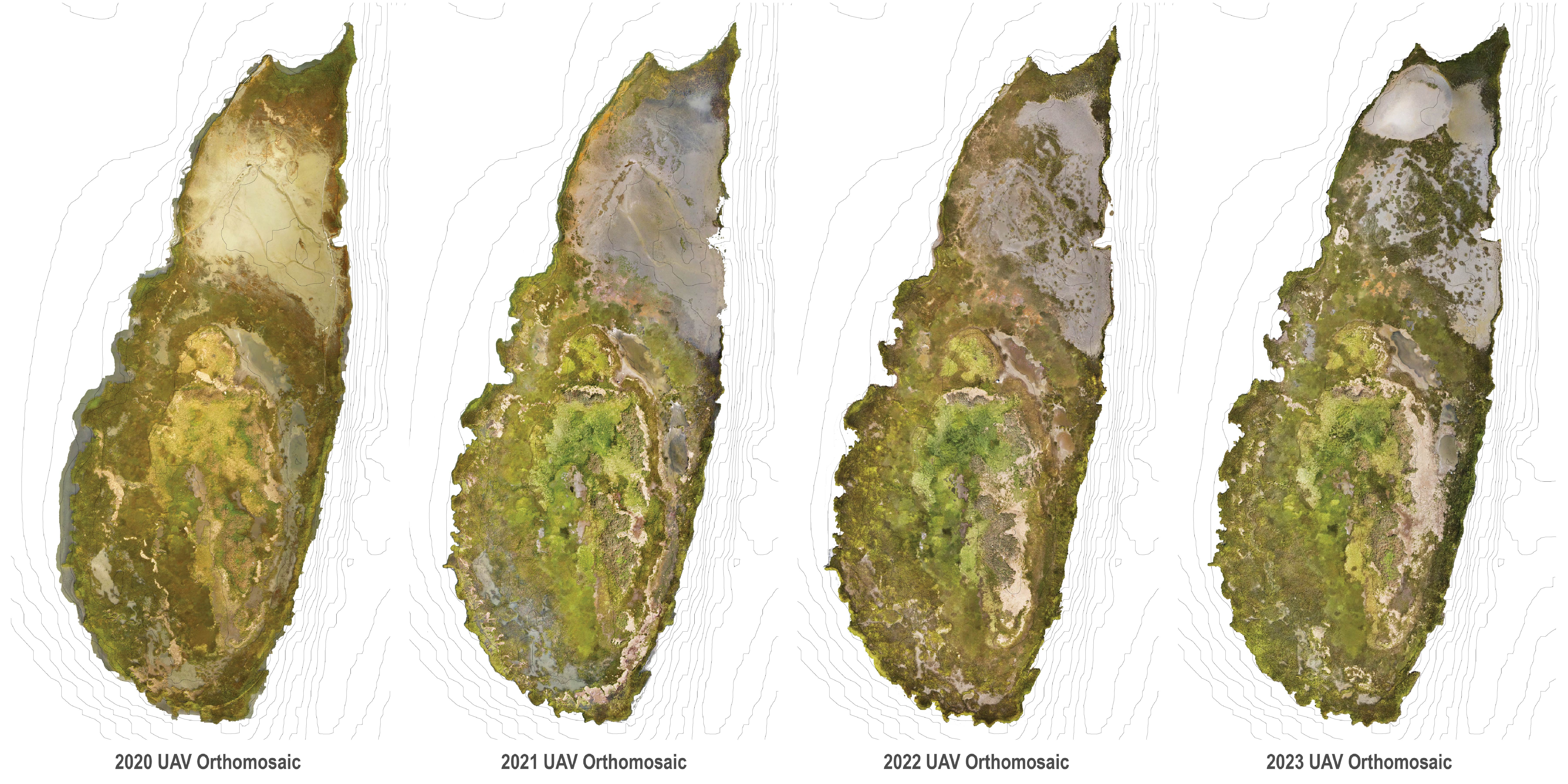
UAV orthomosaics and derived land cover classification maps from 2020 to 2023.
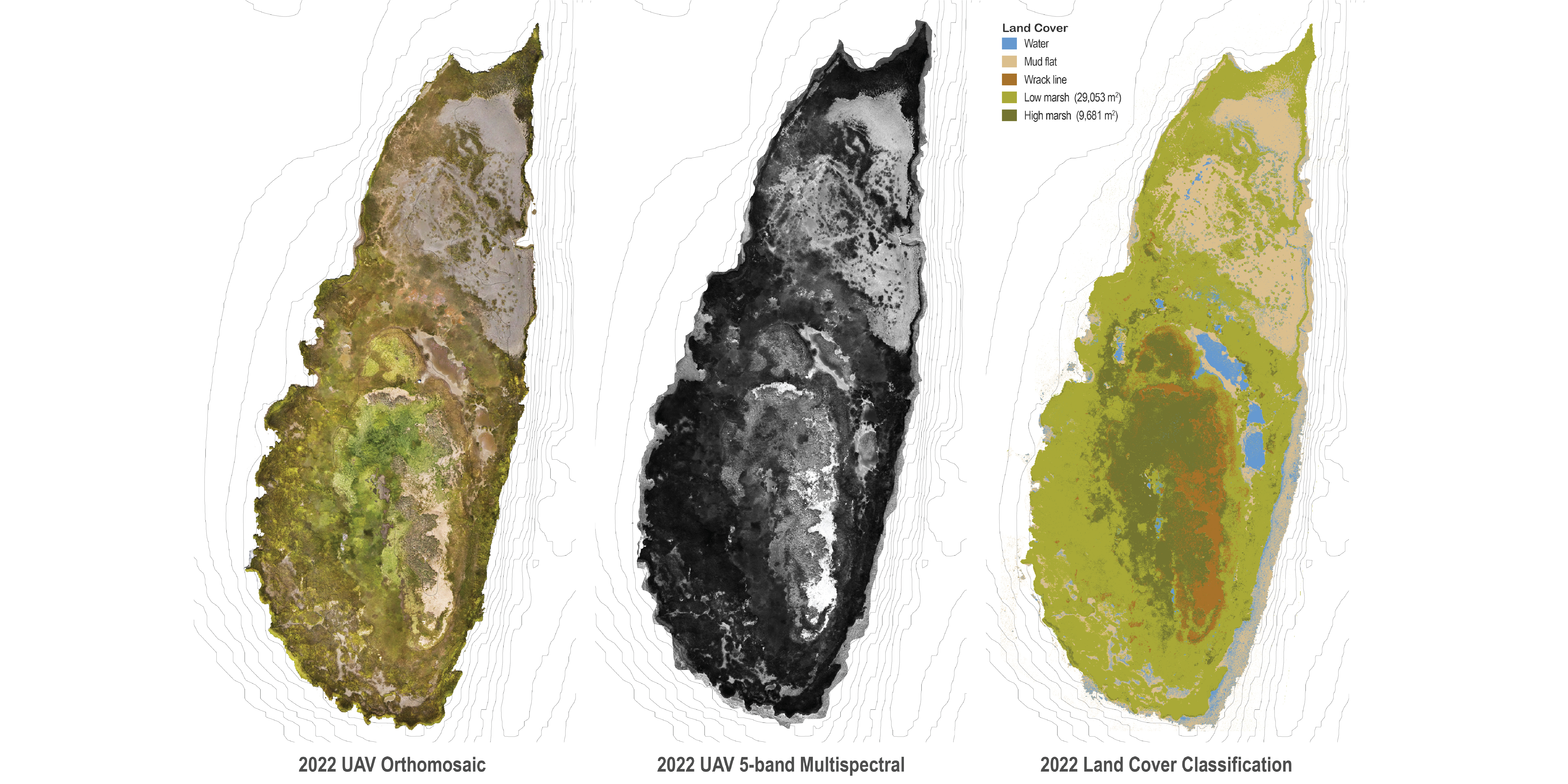
2022 UAV 5-band multispectral imagery with subsequent land cover classification map.
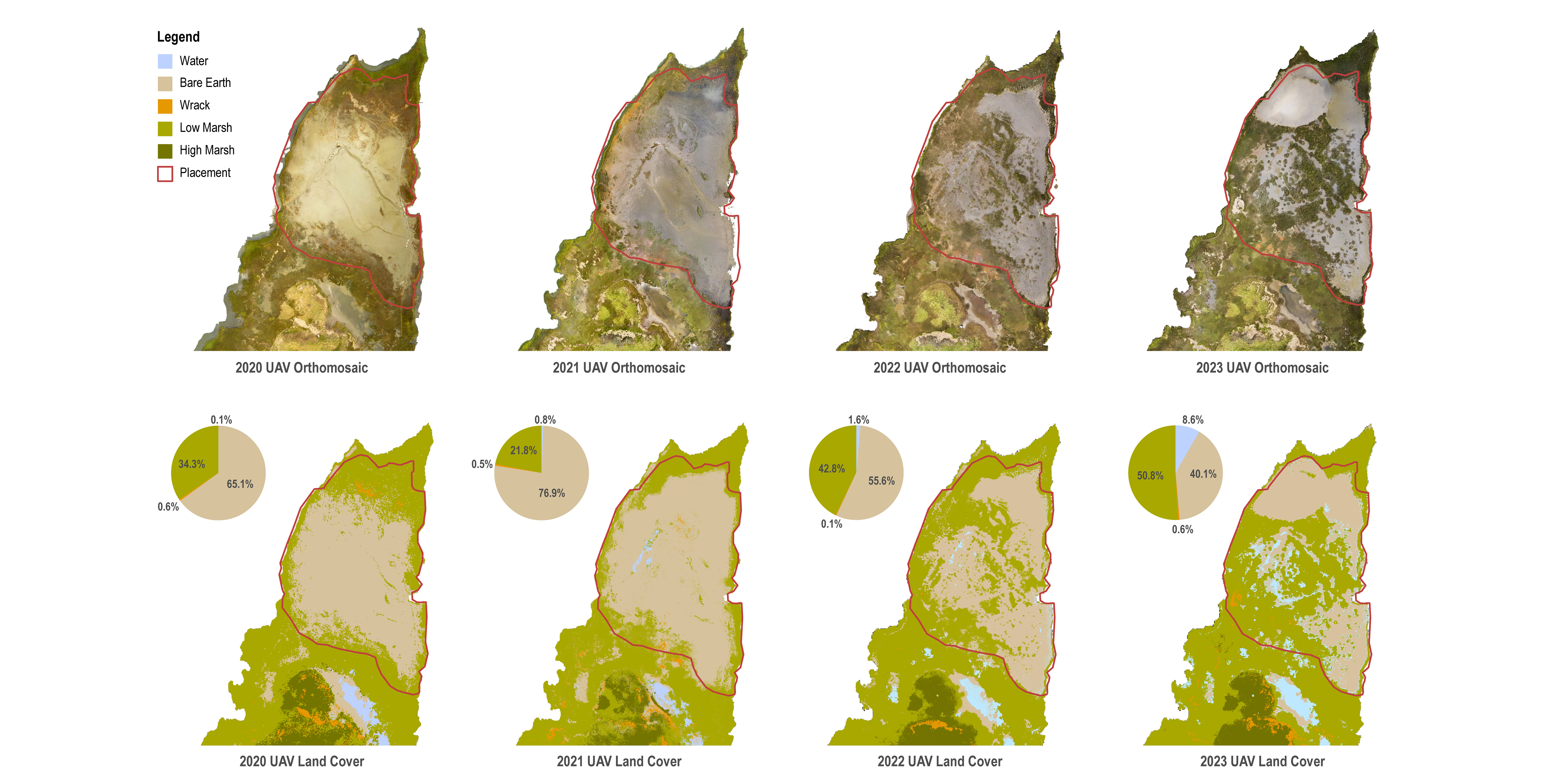
Multi-year (2020-2023) UAV orthomosaics and high-resolution land cover classification maps have been instrumental in understand vegetation recovery post-dredge placement.
Tracking vegetation recovery post-placement is critical to understanding the emerging marsh restoration methods using thick-layer dredge placement.
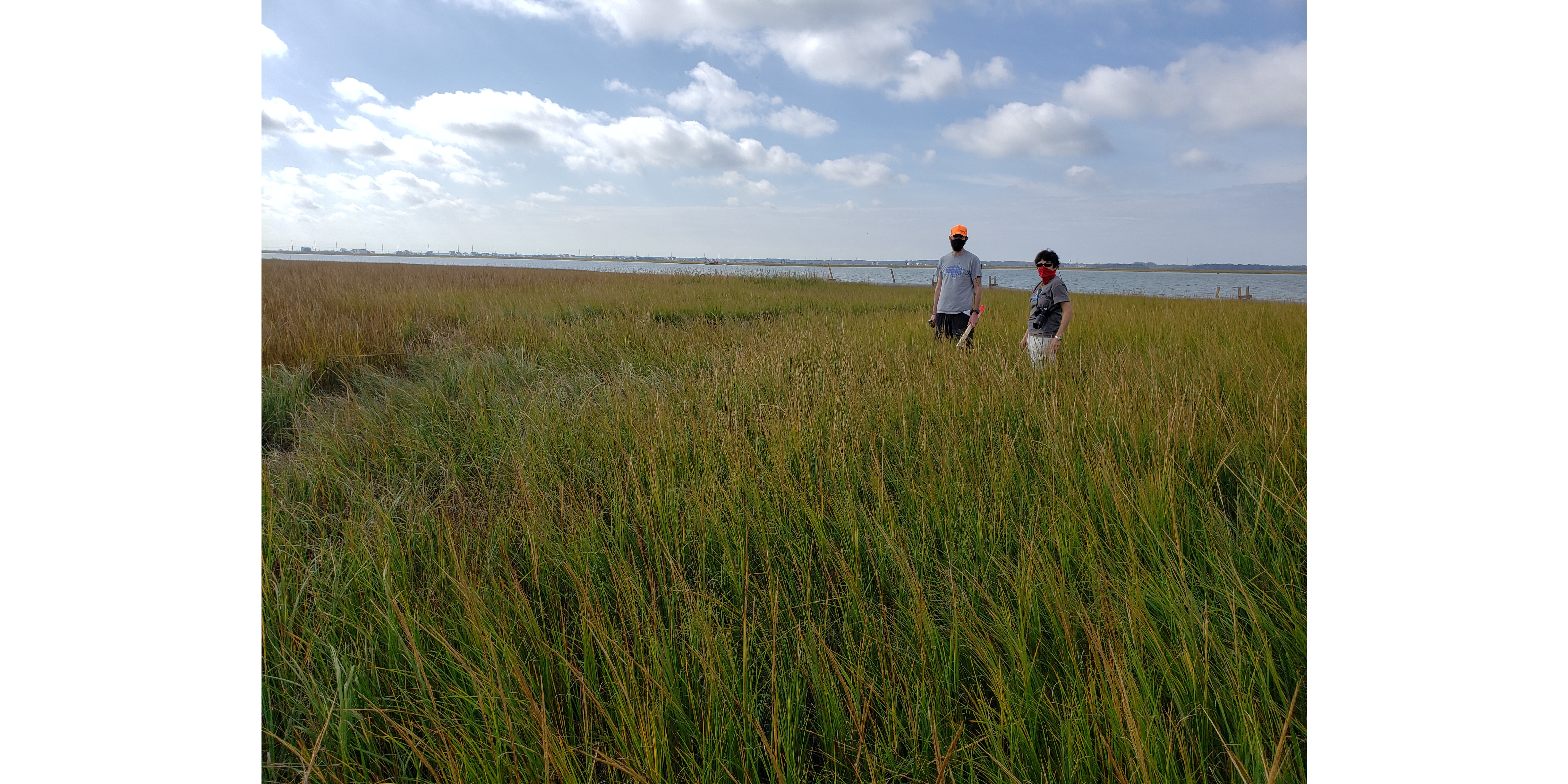
Field visit prior to surveying.
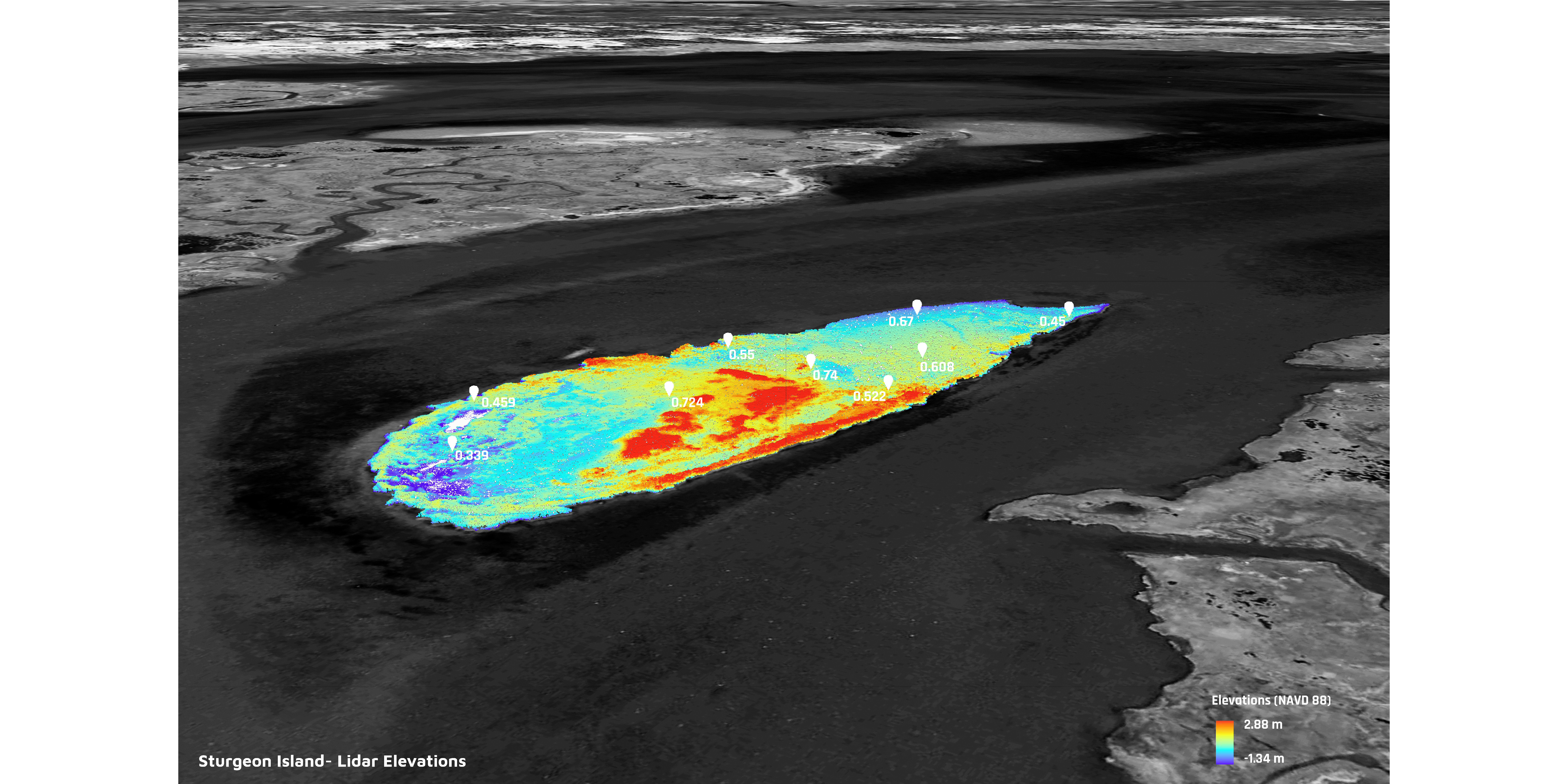
Three-dimensional model of Sturgeon Island. This data will be important for gauging changes in the sediment placement as it settles.
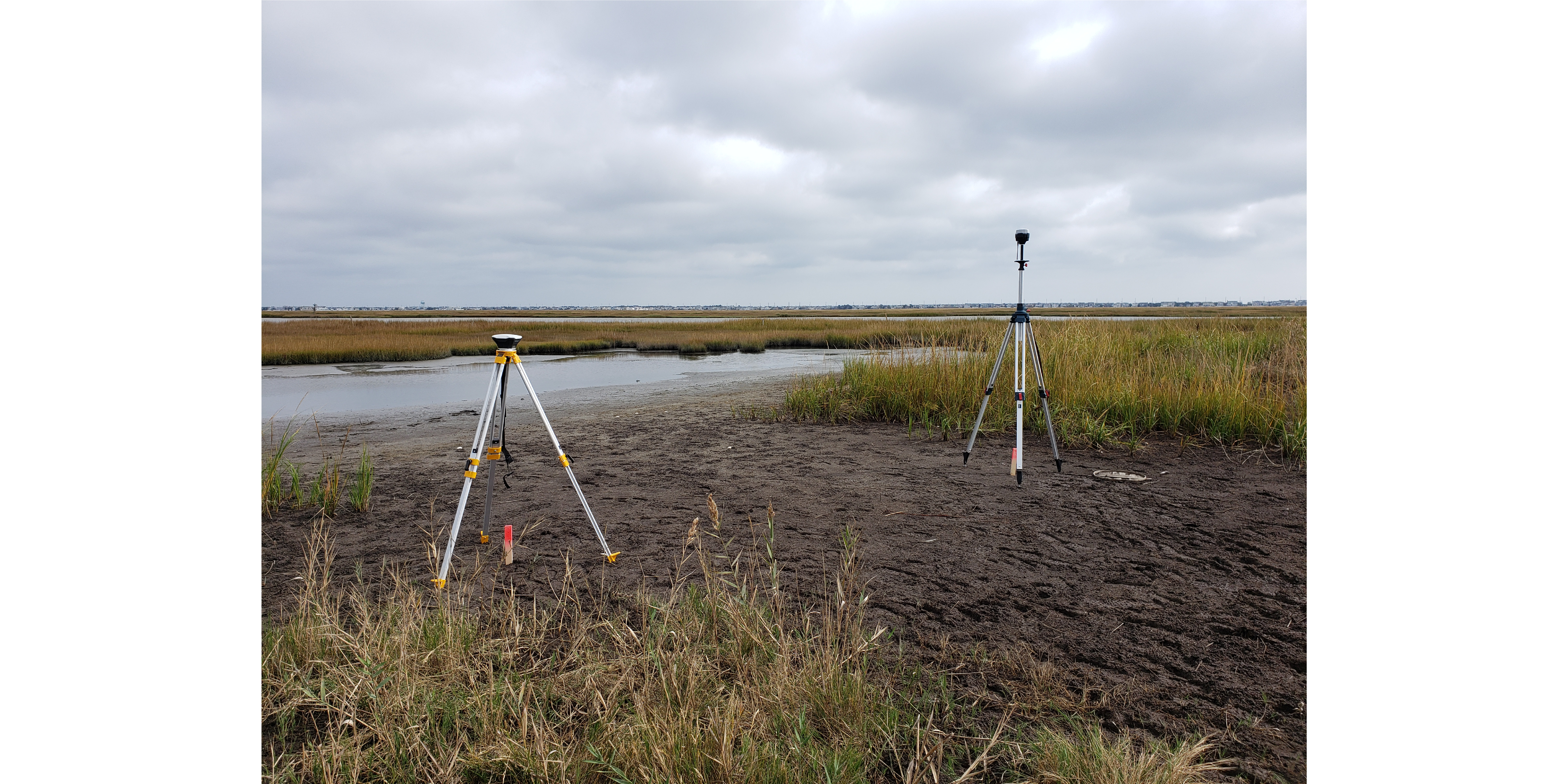
GPS/GNSS survey equipment for measuring existing surface elevations.
Multi-year UAV surveying of sediment placement on Sturgeon Island.
Sturgeon Island UAV Mapping
Led By: Sean Burkholder and Keith VanDerSys
Aerial Overview
© 2020 University of Pennsylvania Stuart Weitzman School of Design
© The Ian L. McHarg Center for Urbanism and Ecology
210 South 34th Street
Philadelphia, PA 19104
© 2020 University of Pennsylvania Stuart Weitzman School of Design
© The Ian L. McHarg Center for Urbanism and Ecology
Office of the Director
210 South 34th Street
Philadelphia, PA 19104