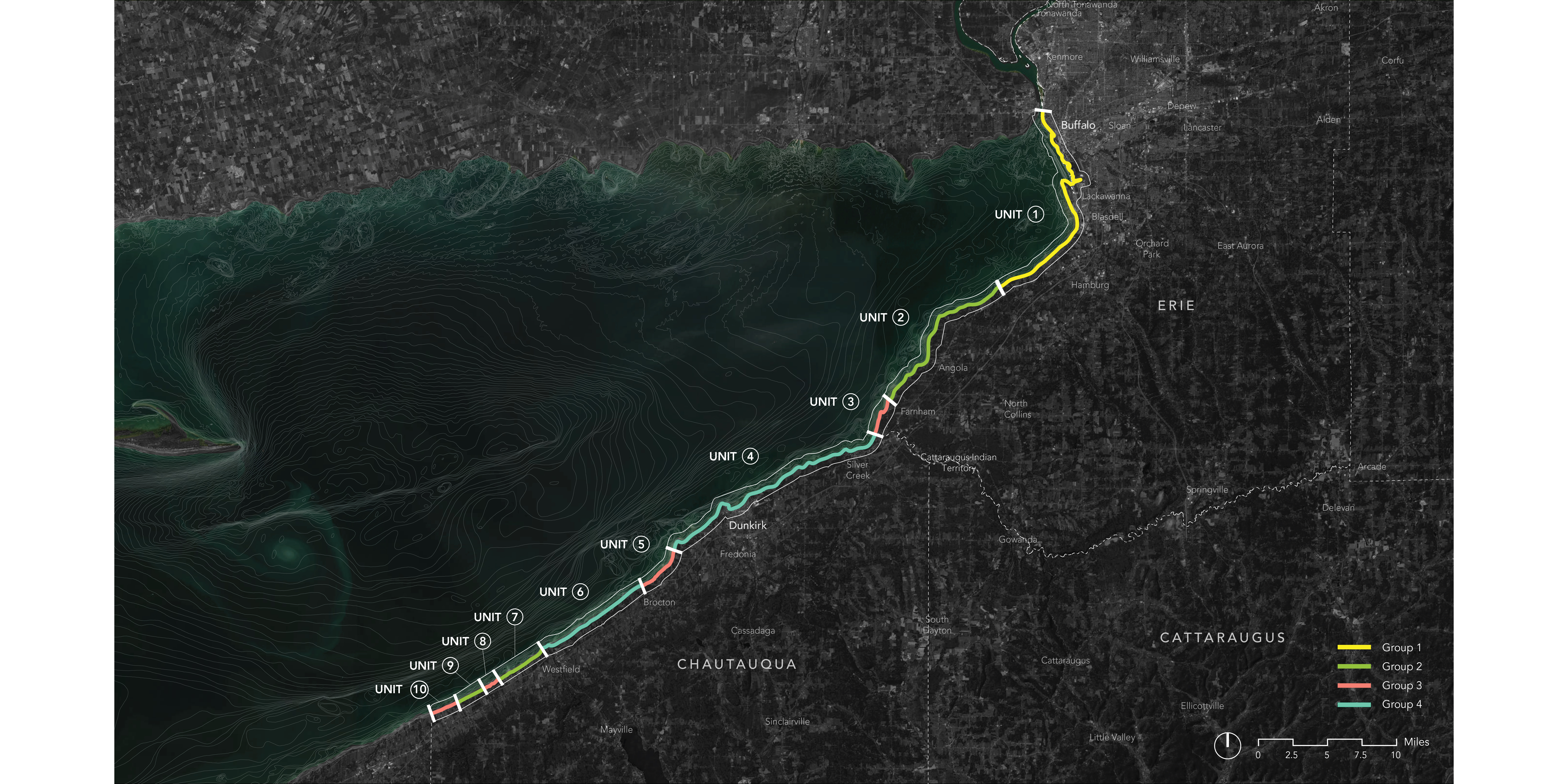
Rather than making a static set of coastal units, our project created a series of data-processing models for dynamically delineating coastal units based on selected inputs. The 10 coastal units displayed in this map represent an example delineation generated by prioritizing sediment loss.

Our working method for dynamically delineating coastal units is described in the above diagram.

These custom visualizations describe various sediment movement types based on USACE Sediment Budget Analysis System (SBAS). We used this data extensively in our project as a way to understand generalized patterns of sediment movement across the region.
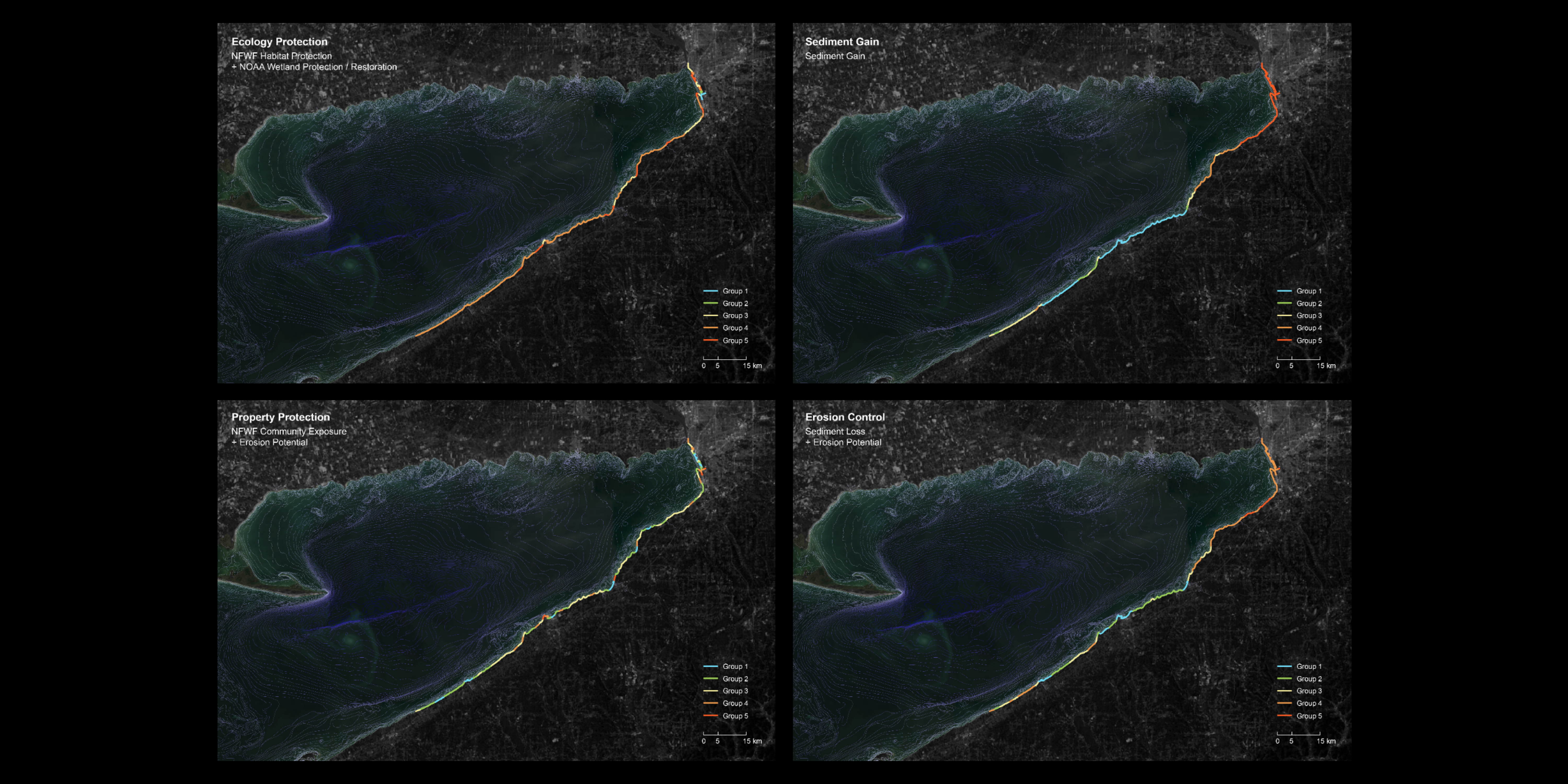
To target specific priorities, our simple models can be strategically combined. The above maps show the combination of models to produce coastal units relevant to Ecological Protection, Property Protection, Sediment Gain, and Erosion Control.

Our public and interactive website will enable local stakeholders and decision-makers to generate a sets of coastal units based on selected priorities, such as sediment loss/gain, coastal habitat, and erosion.

To create final coastal units related to the potential of passive sediment management strategies, we created and combined two models: a Coastal Process Model and a Coastal Conditions Model.
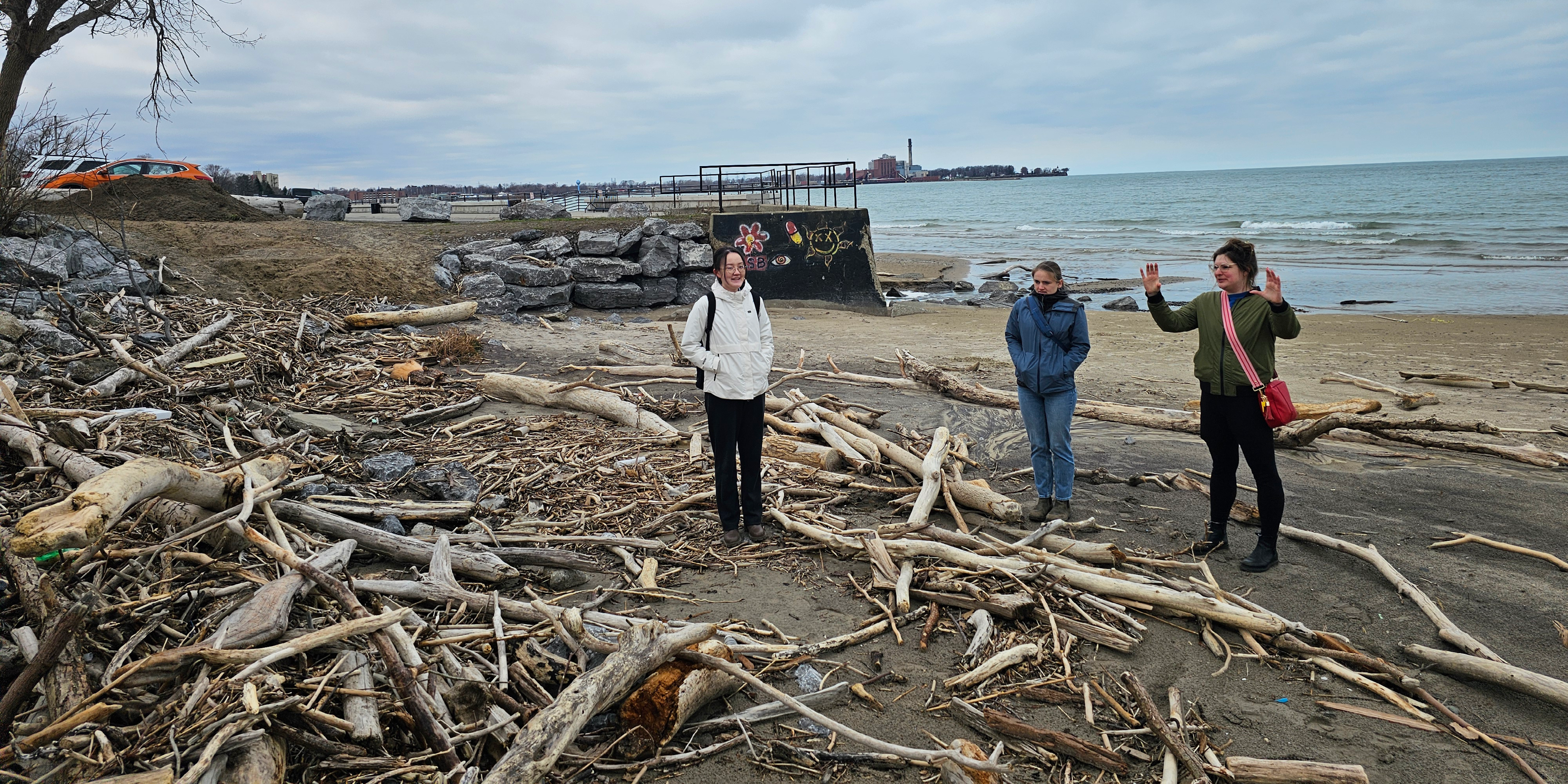
Our team visited a variety of sites throughout our region of study, including Wright Beach in Dunkirk, where we spoke with local representatives about the site's unique challenges and potentials.

Our team Considered relevant Passive Sediment Management Strategy typologies falling into two categories: Process-Based Strategies and Form-Based Strategies.
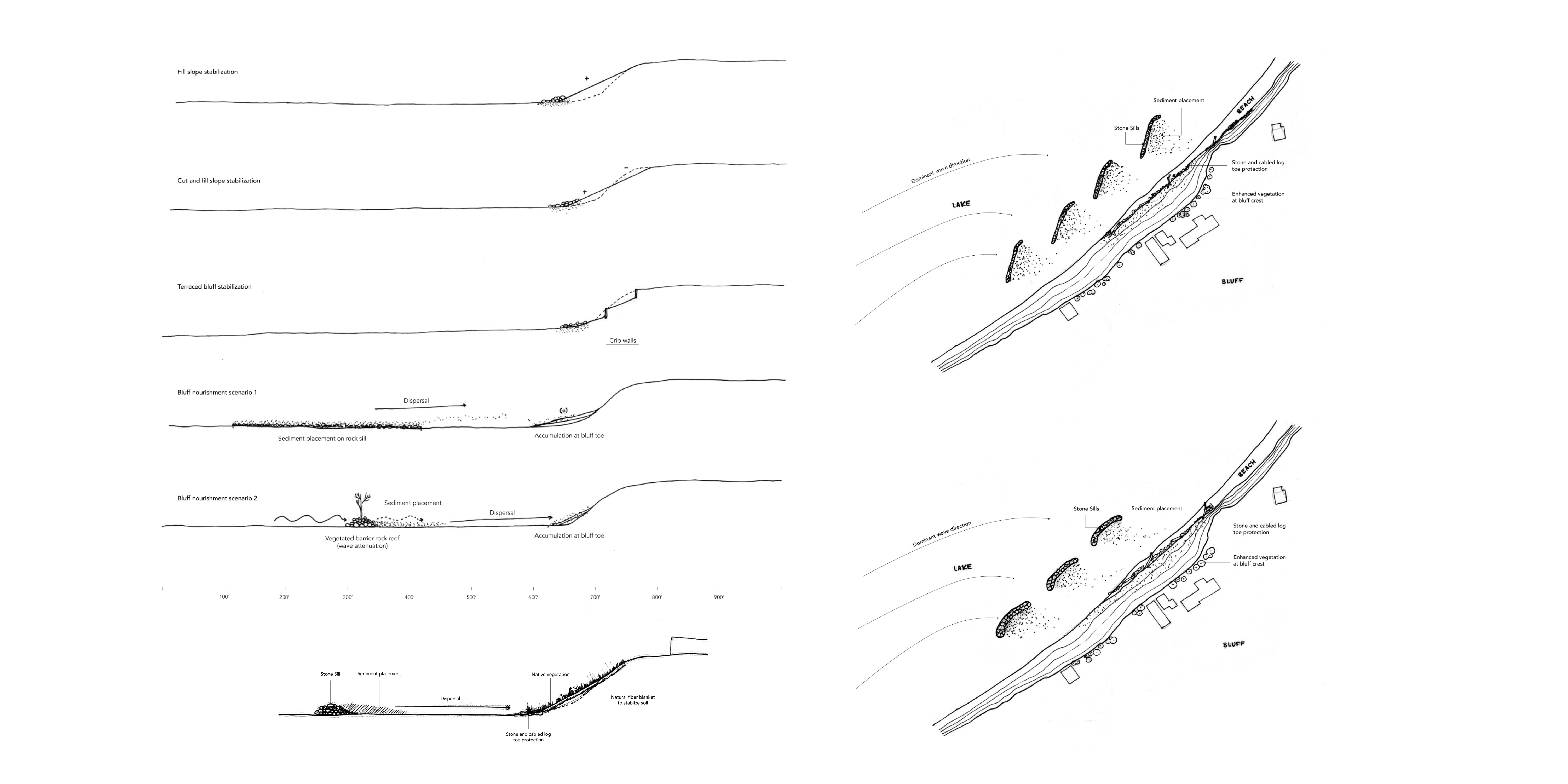
The development of condition-specific design ideas allows for the application of common interventions across a range of sites experiencing similar challenges within our study region. These drawings suggest a potential design intervention for coastal areas experiencing bluff erosion.
New York Healthy Coasts and Communities
Led By: Sean Burkholder
© 2020 University of Pennsylvania Stuart Weitzman School of Design
© The Ian L. McHarg Center for Urbanism and Ecology
210 South 34th Street
Philadelphia, PA 19104
© 2020 University of Pennsylvania Stuart Weitzman School of Design
© The Ian L. McHarg Center for Urbanism and Ecology
Office of the Director
210 South 34th Street
Philadelphia, PA 19104