Tangents
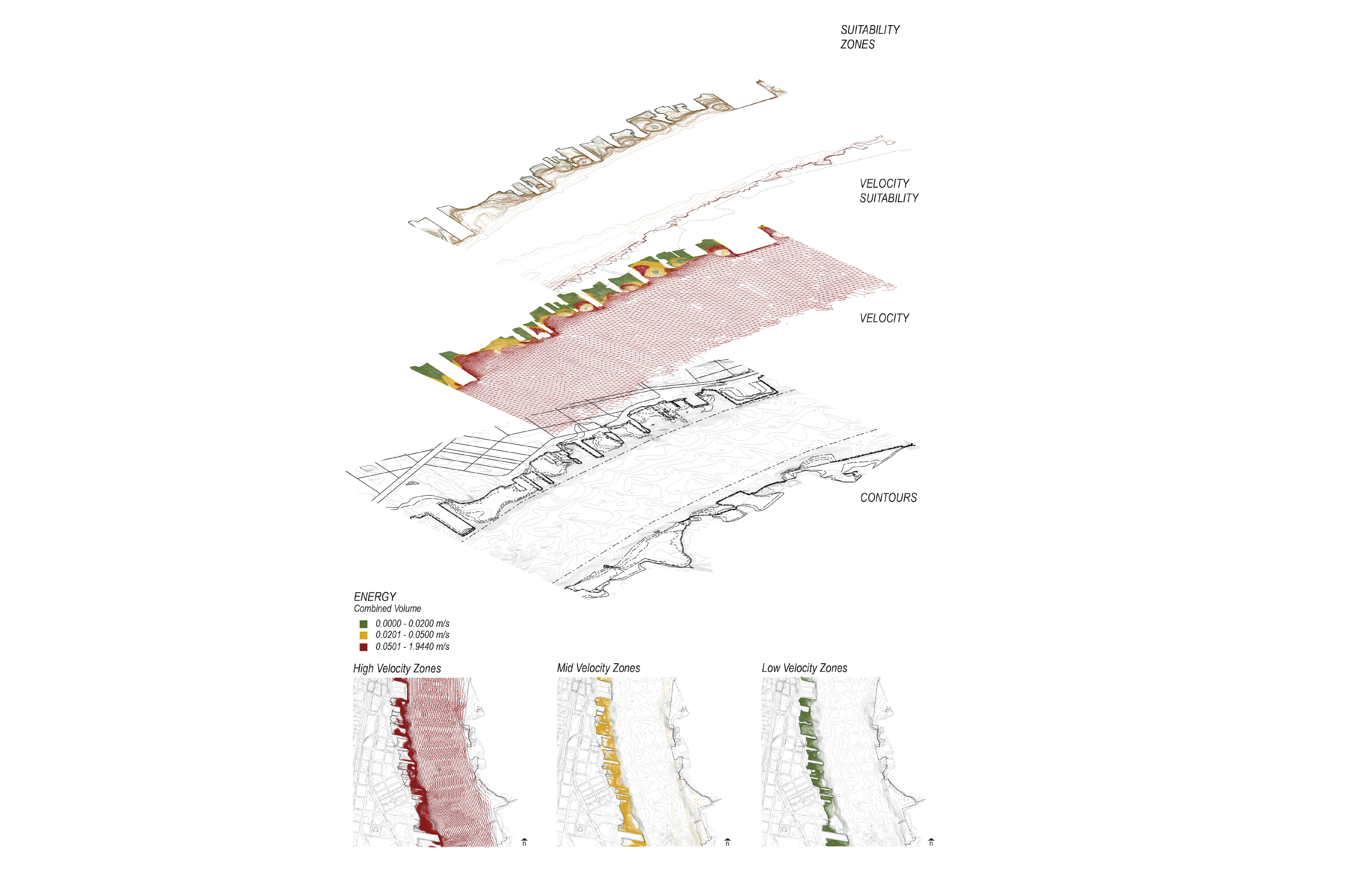
Aquaveo CFD Simulation
Aquaveo SRH-2D simulation of the Delaware River

Aquaveo CFD Simulation 2
Custom Grasshopper scripts were created to connect Rhino, ArcGIS, and Aquaveo
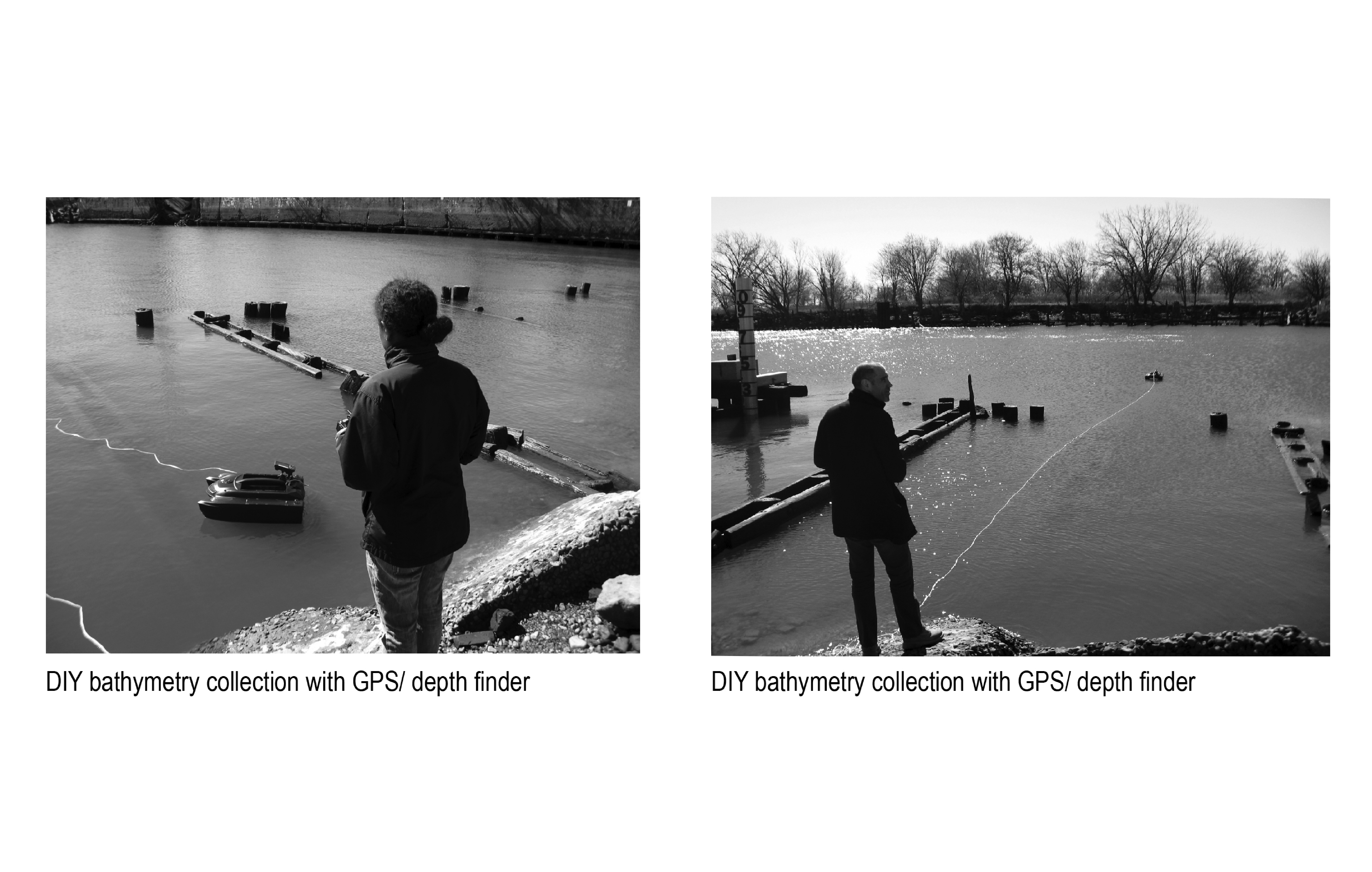
Bathymetry CollectionA custom bathymetry drone was created to collect missing shoreline depths in the river
External Contact
Office of the Director
Connect

© 2020 University of Pennsylvania Stuart Weitzman School of Design
© The Ian L. McHarg Center for Urbanism and Ecology
119 Meyerson Hall
210 South 34th Street
Philadelphia, PA 19104
210 South 34th Street
Philadelphia, PA 19104